This vacation week I had a mini-cold, we had a major cold (like temps of -30's with wind chill factor) and most days were gray.
So as you can imagine (or maybe you can't, hence the pictorial representation coming up), my outlook shifts. I try mightily each year (last year even purchasing one of those ridiculous sun lamps that the cat loves + sits in front of, hence blocking my exposure and only darkening my mood some more) to look on the bright side, take to the car to ride around and see the bright side, but this is what I find:
 Frozen in time because we've plaqued it. Words pop- "valued" by The Indians, "granted" to white man and "exploit." A little plaque has so much unkind history packed behind it. This was in Fiskdale, MA. A largely wooded small town with 3 bodies of water and population of about 2,000 mostly white folk. I often drive around and wonder, "where have all the Indigenous people gone?" Did they really ALL get driven out or killed by the white immigrants or did they assimilate and hid their identity? Our proud history of manifest destiny practically wipes them out of the books, excepting to depict the warring ways and days.
At least we pay homage to the people who came before us in some of the names found in the region. Mashapaug is the name for this street, but it also is the name of a pond in Rhode Island, and a lake in Northwestern Connecticut. Can you guess the Nipmuck meaning of the word from the series of pictures above and below?


The smell and feeling of desolation in quiet frozen places can't be captured by photos. This is visceral. This is my bones responding to the crisp, cold air in silent protest. I want to find beauty, but I never do in New England in the winter. Never.

 I travel on to the next little spot, next little town. Holland, MA home to my summer camp over 40 years ago! I am always a little surprised when I stumble upon this place (or kayak over to as I did a few years back)- it sits on another small body of water named Siog and has been there since 1928. Named Camp Mishnoah, it is owned and operated by the Boys + Girls Club of Springfield, MA.
 Holland, MA has about 2400 people and lots of woods. It collided with the tornado that wrecked havoc in 2011 and pieces of Holland and many other small towns around the area still look scarred. The camp received some damage, but not at the roadside section you see above. I couldn't even find any current information on the place, despite a nostalgic interlude several years back in which hubby and I volunteered to do some clean-up in attempts to keep the place viable as a multi-use property (after the highly publicised disappearances/murders of young girls in the area and the unpublicised, whispered gossip among townfolk that there may be a serial rapist/murderer of young girls, attendance at the remote summer camp for girls went down).
http://articles.courant.com/1996-08-10/news/9608100315_1_death-penalty-neighbor-killed
http://patch.com/connecticut/vernon/local-missing-girls-to-be-featured-on-investigation-ddd8c43a171
Anywho, I travel on out of this area, for as much as I loved it as a kid, coming to this distant and foreign land (which really was only 45 minutes or so away) and learning I'm sure hokey and mostly made up lore about Indians from the area (hence the camp name of Mishnoah which to this day I don't know what it means nor where it was derived from), now I only see gray and slightly disturbing scenes.
 This slightly larger town, Palmer, MA also has a "days gone by feel" and ugly look in the winter. Population of 12,000, I am not sure what is the draw to the place, nor what made it once a viable place. In my mind it is not a mill town, therefore I mostly have driven through it. I see it as a drive-thru town. In some weird re-routing done years ago, the major roadway actually bypasses this section photographed above and below (lower Main St. I'll call it). As you can see you don't miss much.
 What I did miss, was the one attraction in the town that I really wanted to see= the H.H. Richardson designed Union Station which is on the left in this picture. This station and the grounds around it (designed by Fredrick Law Olmsted) were once premiere sites. It's a pretty big deal to have the two aforementioned men designing shit in your town, and I was so bummed to see the ugly thing overshadowing my search site, that I couldn't bear to go check out the station.
 And in case you are wondering about that eyesore, it was once the headquarters of Flynt Building and Construction Co. (1885), and is still called the Flynt Bldg. I wonder what the descendants think of this (hey, maybe it was one of the descendants who did this!)
A great short historical piece on the Flynt Quarry in Monson:
http://www.opacumlt.org/documents/DS-Flynt.pdf
and from this document, check out what the Flynt Bldg. looked like in 1885:

Here is some historical information on the train station in case you should decide to go:

https://youtu.be/X3sh12y8hws
Steaming Tender Restaurant

At least it is salvaged, right? The granite came from next door quarry in Monson, MA and the brownstone trim from just a little bit down the road in Longmeadow, MA. I just adore that things were built solid and strong and local for a period of time. It somehow makes me feel more grounded to look at this enduring structures. On the flip side, decay and lack of care to some of our heritage sites makes me sad.
 Before I left, I drove down and across the RR tracks to...you may have thought I would have said Mill St., but alas, this time it was the other street that I typically look for when I am sniffing out Industrial pasts- Water Street. Water and RR's usually somewhere, somehow lead to mills. Not the case here (other villages in the town hold that history). All there was on Water St. were a few run-down homes, and bleak scene of railroad yard and junk. But in the other direction, across the water, and into the neighboring Monson, MA (pop. 8500) was this gigantimous place. An 1860 constructed, 14 room, 3,856 sq. feet stately home that is now a multi-family (3) dwelling. I sure wish I could find out the history of that property. Somebody with a few bucks and some local prominence once lived there, I am sure.
If you are interested, and/or enjoy hunting old town history as I do, check out this cool site I found that has an entire Palmer history tour!
https://www.geocaching.com/geocache/GCTYB8_the-palmer-history-tour?guid=b4a09323-4ac8-4303-8252-d7959bc2a1b9
I did manage to find Mill Rivers and Mill Streets this vacation, but not Mills themselves.


Who knew? Another one of those drive-on-by places that most (of course not I) don't even see because the landscape has changed so much. Many of the Mill St.'s I find are but pieces of once was a road that ran along the river or brook that powered the mill that provided the grain or wood or a plethora of other small industrial concerns.
This Mill St. in Northfield, MA a town that borders N.H. up...North is full of Indigenous spirits/history that isn't very well preserved. The Sokoki tribe were the folks in the region in the 1600's and the village was named Squakheag prior to colonization in 1673. It wasn't pretty making this town a colonial concern. Massacre is a word that would describe the eventual fate of the original inhabitants along with other not-so-nice words such as "displaced" or "sold into slavery."
These next two houses aren't actually on Mill St., but are located across the Mill Brook on a short st. named Glen Rd. both streets dead end, but the Mill Brook drains into the Connecticut River not far from here.

I am guessing that this home is 25 Glen Rd. a 1897 multi-occupancy 6 bed, 2 bath 2,903 sq. ft. home (last sold in 2000 for 134k)

This one I think is 18 Glen Rd., considerably older at circa 1790. It has 4 beds, 1 bath, 2,640 sq. ft. and is estimated to cost more than double its neighbor.
Much of the Main St. that runs through town (also known as RT. 63) has enormous stately homes, much of it owing to native evangelist Dwight Lyman Moody and his building of a Seminary for girls on a hillside on the East side of Main St. which was also used for religious conferences and in turn led to the buildup of this small New England town as a summer resort.
For those history mystery murder lovers like me, there is great reading about the companion site Moody developed for boys, Mount Herman on the West side of town.
Dig the name of this site, The Malefactor's Register. Yes another blogger like me. Here is the link to his blurb about the crime:
http://malefactorsregister.com/wp/death-comes-for-the-headmaster/
 The book was a lovely winter's read a few years back.
But back to my old houses on the tiny side street of Glen Rd. and Mill St. and the Mill Brook in Northfield.
Northfield, MA like many New England towns formed in a linear way, on a single main thoroughfare. So little information is out there for the side streets. Northfield then and now is known for agricutural crops of tobacco, hops and charcoal, not Mills. An interesting side note is that Maple Sugaring, now seen all over the region and in the small hilltowns of Western, MA is noted as starting in Northfield by the Scots-Irish who came to the region in mid 1700's.
The Mill Brook was named Cowas and Coassock in deeds made with the native folks in the late 1600's. Roughly translated as the pinetree's place. Grist Mills and Saw Mills were then built but up stream from the site I was at. In 1717, Saw and Grist Mills came to the West side site and a damn was also built by the Belding Brothers (Belding Rock is a historic marker on the main drag commemorating the scalping of Aaron Belding in 1748).
https://www.geocaching.com/geocache/GC3CJ90_captain-beers-last-stand?guid=f26b2fd0-9d9d-43cb-892b-56dd29d28a4b
If you like Geocaching and history related to King Phillips War, another hunt in Northfield,MA
and if you, like me, love history and anything mill related here is the proposed Millbrook Conservation Area report of 2006:
http://www.northfieldma.gov/sites/northfieldma/files/uploads/millbrook_report_2006.pdf
In 1874 George Long built yet another Saw Mill on Glen Rd. I'm betting one of those houses above belonged to him.

A 20th century industrial concern on Glen Rd. Not sure how successful it is/was, but it sure speaks to the Yankee Ingenuity that abounds in the region!
The West side of Mill Brook led to a ferry crossing on the Connecticut River in the 18th century, and I could see traces of this road as I tried to drive down Mill St. Glen Rd. actually goes on further than Mill does, and it is up this road the walk/ride was from the ferry crossing.


So the last mystery for me was the house above.
There is much written about the east side of Mill Brook b/c it involved big money and big building (like castles and huge hotels and boarding schools). There was a family in Northfield named Webster that it looks like from old maps had a mill on this very site. Henry William Webster (1841-1893) was listed as the owner. Arad Webster (1795-1872) was also on the map right next door to his son. He is mentioned as a blacksmith, saw-mill and grist-mill owner.
Mystery answered (somewhat)- question remains: who is there now and is the home extant, converted, or ground-up construction. Front facing looks like the remnants of something old, and all the rest of the house is stone, but looks new.
The most I could find was that there are 2 houses on the small street. This one has to be the 1800 house that was sold in 2006, and it has been done over. Another of those, I-wish-I-had-the-courage-to-knock moments. But in todays world, and out that far, I could have been met with a muzzle. So I just admired, snapped a few and drove on.
Then before too long I emerged in another Mill St. area, this time in the big city. Springfield, MA (about 150k population last I checked, but #'s dropping fast).

This Mill St. and Mill River has been a mess for a long, long time. It bums me out to traverse these streets no matter what time of the year. The last time I tried to make my way off the highway in this area for one of my bff's PhD completion party, I was snarled in a jam and missed the party altogether. That was on a beautiful sunny Sunday afternoon about 1:30p. Little did I know someone was being murdered while I impatiently snorted at my delay. All kinds of construction all over this part of town in preparation for the big Casino coming. More heritage landscape going by the wayside. This place too was/is extremely historic for not only a piece of the King Philips War, but also John Brown's factory, and all the other Mills that once dotted this old, old settlement. I dropped my offerings at the Springfield Rescue Mission's new home of 10 Mill St. (a former Cadillac dealership it long ago lost its appeal to me, although I once did a scavenger hunt with a class and so I know there is a marker right in the middle of the road near here, but with all the construction going on I couldn't sight it. Who knows, maybe its gone?
As I sped out of my old hometown, one last shot solidified my gloom on this dreary February day:

It has been up to -30 degrees in the region with the awful wind chill, how can these folks survive? Home in a cart, travelers on the road of...of what? Lost hope? Misery? What? Once again I so desperately wanted to stop and ask. My troubled, depressed yet still curious mind wanted to know. I did what it has taken me a lifetime of concerted effort to do- I drove on.
Back home in the hills, the woods, the serenity space did not bring me peace. It brought me these final images that I drive by on a regular basis without ever really looking.


These two so reminded me of my dad I just wanted to cry. But I was afraid if I started, I wouldn't be able to stop. "Drive on," that voice reminded, "drive on."

There were not slow children playing here, hadn't been for a long, long time and rust never sleeps.

No plowing...
 No Henhouse eggs laid...
 No lay-ups made...
No backboard rebounds, no farm animals/farming in sight.
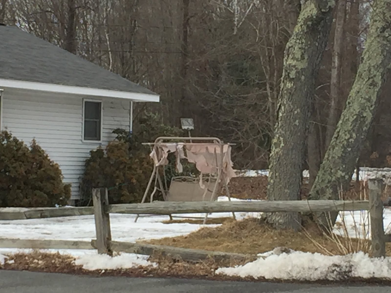
No romantic rocking rendezvous...

No way home...
Except I could hear all those ungraded papers calling me, all those lessons unplanned. Vacation week come and gone, and it was all so bleak and frigid.
Have I mentioned how much I dislike this time of year in my beloved New England?
February is NOT my month!


