Friday, August 1, 2014

“Excursionists," love that title!


A little dated (was in vogue in the Emerson, Thoreau era of traveling to the country to commune with nature, be healthful and spiritually whole), but that's ok. It's up for grabs in our free market society, so I'm taking it. No longer a Sojourner, I am an Excursionist. I bet I could make a profession out of it too.

Some excursions are planned, others just happen. And then there are the hybrids. This one is a hybrid.


I signed up for a kayak meet-up in a small (pop. about 8,000) almost central MA town of Orange. I knew little of this town excepting it has a great festival every year: North Quabbin Garlic and Arts Festival. 


Here's what the town says about itself:

     
From 1780 to 1840, Orange was primarily a farming town. Many of the farms were large and well managed. However, various industries eventually sprouted along the banks of the Millers River, including the New Home Sewing Machine Company, which in 1892 produced 1,200,000 sewing machines.
By 1879, the town had a population of about 2,000 people, many employed in industry. Orange was also the site of the first automobile factory in the United States, at the current home of Pete's Tire Barn on East Main Street, built in 1900.

Here's what the state says about the town (from the MHC Reconnaissance Reports, a favorite pastime reading):

Well I was going along to the Millers River and so of course I went early to excurse along the River and R.R. to sniff out what was left in this little Mill town. I was really curious about the New Home Sewing Machine Co. b/c that factory had operated into the mid-twentieth century. The river and railroad run right thru the center of the town. I thought it funny how the town was set up


Which way to go? I went all ways. I went North Main in search of the old town center, but didn't find it (I didn't go far enough + it really is more Tully Village- which also has a Main St.  and not Orange). You see, I also sometimes study things like this:

Massachusetts Department of Conservation and Recreation Central Massachusetts Regional Planning Commission North Quabbin Regional Landscape Partnership Report

I really think in a past life I was a cartographer and in current form I dream of being on a planning commission somewhere writing reports like these great ones. When comparing the two reports, I sometimes get to see what is extant and the town has preserved, or is trying to preserve, or is sitting to rot (which sadly is what I most often find, hence my fascination with our nation's decay).

The DCR is where our state parks operate out of. Of course I have my seasons pass so I can drop in to the lakes that are no motorboats. Little did I know they produced this cool project in 2008 with an affiliated publication, "Reading the Land." So I pulled up Orange and found a wealth of information.

I let it go that I didn't find those old pre-industrializtion places, because I passed so much brick in the downtown that I turned around, parked and peeked. I'll let the pictures tell the rest of the story.


Vacant former Erving Industries paper mill on West River Street.
In the 1990s, Erving Industries sold the facility to Innovative Cereal Products, Inc., which has since ceased operations.  
http://www.mass.gov/eea/docs/dcr/stewardship/histland/recon-reports/orange.pdf


Located on South Main Street, on both sides of the Millers River, are the buildings associated with the former New Home Sewing Machine Company (New Home). Originally the site of a mill that
manufactured wooden pails, New Home started their operation in the early 1860s under the name Gold Medal Sewing Machine Company. The name was changed to New Home in 1877 and the
business thrived well into the early 20th century. Built of brick, the architecture and configuration of the buildings is typical of 19th century New England mills.


View of the New Home Sewing Machine Company buildings from the Millers River looking west. Main office building is seen on right side with awnings on two front windows. South Main St. bridge can be seen infront of the buildings. Circa 1910-1920.


View from the South Main St. bridge looking north at the main office and needle department buildings 


I was curious about this building in the center of town, the Orange Trading Co. and found this video someone made in 2011. It gives the overall feel of the town.


But it doesn't tell the history. The DCR report just states that many of the remaining Sewing Machine Co. bldgs. are now privately owned. On the left side may be where there is still manufacturing going on. The Slencil Company owns several buildings on the north side of the River and remains a thriving pencil manufacturing business (with an owner that somehow thought Slencil was a cool name). 

Several buildings on the south side of the River are under-utilized or currently vacant. All of the remaining buildings associated with the former New Home Company are contained in the Orange Center Historic District listed on the National Register of Historic Places in 1989.

This multi-purpose home sits at the 4 corners of the Mains (North side). It is a tanning salon/hair joint. I did neither, merely parked + walked around.


I know what some might be thinking, "Look at that crazy car with a kayak sticking out of it!" I tried to hide it, but you know...


This drinking fountain, another enigma, caught my eye, piqued my interest.


So I searched and found this:

At the 1874 organizing convention of the National Woman's Christian Temperance Union, the members were urged to erect drinking fountains in their towns so that men could get a drink of water without entering saloons and staying for stronger drinks. Often the drinking fountains that were erected offered a place for horses to drink, another place for dogs, and of course, a place for humans to drink.
Many of the fountains erected by Local WCTU Unions are still in existence - some still giving water; and a number have been restored within the last few years. A few remain in their original location, but many have been moved to parks or other public spaces.
AND INDEED, Orange, MA is on their list as having a remaining fountain!
Next I wanted to know what the lettering on top said, but couldn't make it out. Can you?
Across the street from the salon, on the West Main St. side stand these two forlorn buildings. The one on right is in reuse as the Pizza Factory. This site 11 West Main, was established as State Savings Bank in 1871. The 2nd structure is Putnam Hall, a sad boarded up building that has been waiting too long for redevelopment.


It's the corner bldg. that I was curious about. I adored the panels created to spruce up the blighted bldg. and wondered about them. No informational plaque to be found though. It looks as though it were a kid art project of some sort, involving history as the next few photos will show:


 http://yes-inc.org/press/articles/8-17-1999_20080317020409.pdf

The panels represent the different periods in Orange history from the Native American period, the Colonial period, the Industrial period and finally the present and future envisioned period. 


This last picture has lost most of its paint, but what remains are pieces of the letters that spell out the Young Entrepreneurs Society. Young Entrepreneurs Society (YES) was founded in Orange, Massachusetts in 1998 by a community organizer, Tim Cohen-Mitchell, as a project of the Orange Revitalization Partnership and incorporated as a non-profit, tax-exempt 501(c)3 organization in 2000. Since 1998, YES has facilitated over 50 projects and programs, serving over 2,000 youth in our region and beyond.


 Look up and dream!  Putnam Hall is an historic five-story brick building with approximately 22,700 square feet in the center of downtown Orange. The goal is to restore this structure for mixed-use purposes including retail space, professional office
space, light manufacturing, and classroom space for educational uses, which will support ecotourism, forestry, and other businesses, especially in the medical and legal fields.


 Poor, poor Putnam Hall :( The  decorative cornice around the top of this hx'ic building is crumbling away.
This vacant bldg. on West Main looks as if it was once a gas station.  
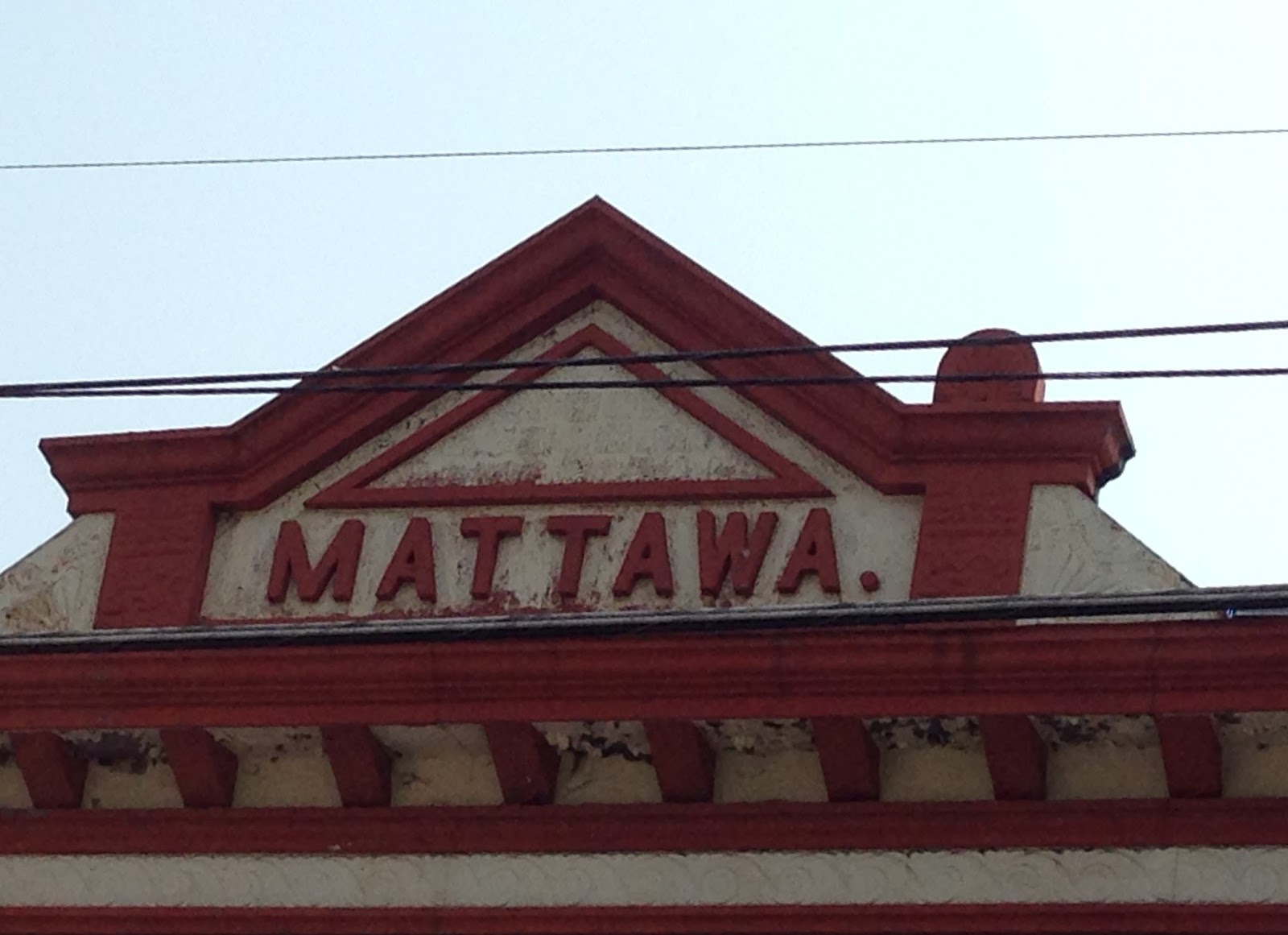
This bldg. was not vacant, houses the Community Clothing Shop (which wasn't open), but I thought the top of the bldg. interesting, wondering what it once was?

The rest of West Main St.:
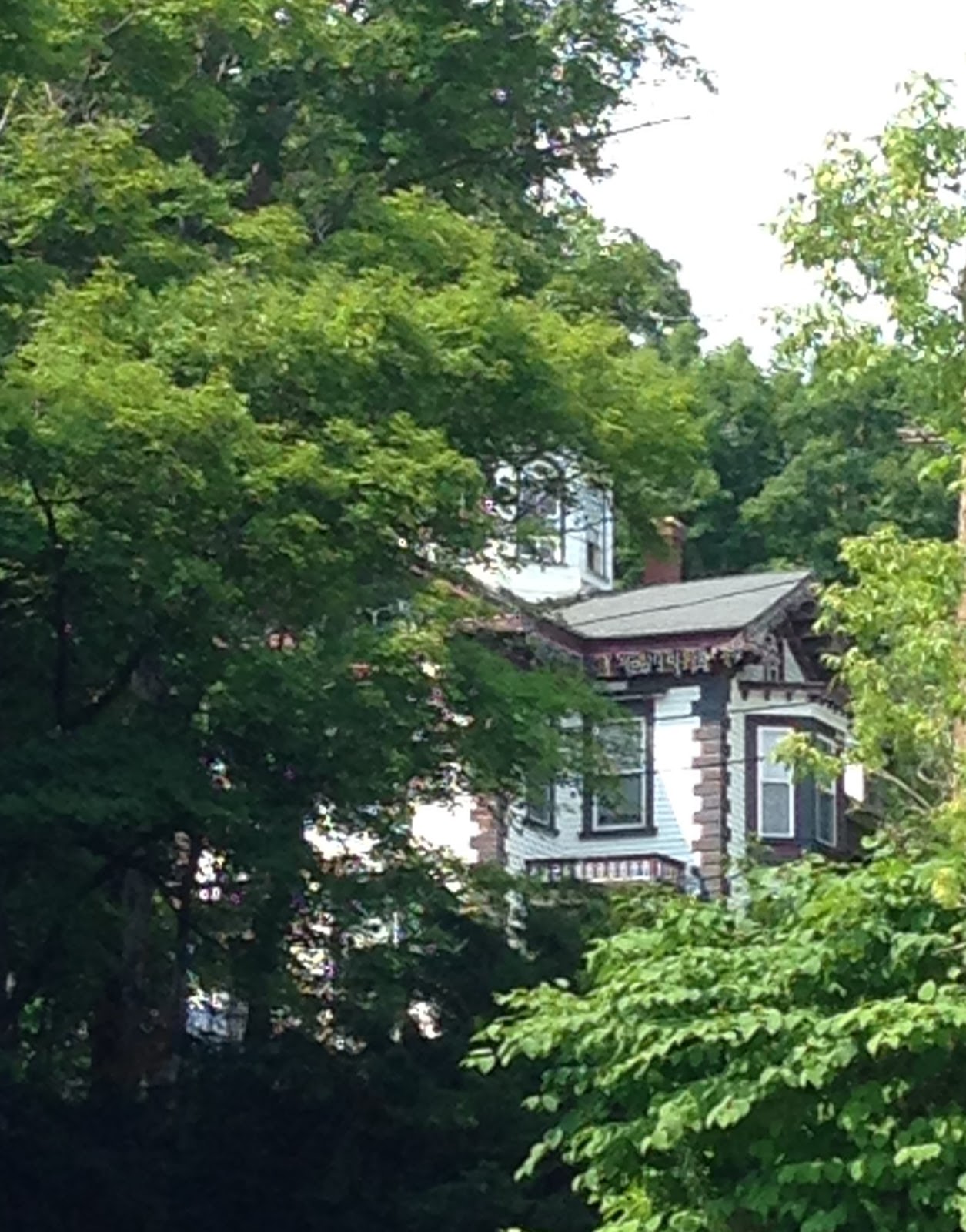

Peeking through- prominence once lived there thru the trees behind West and North Main St. (I think this was either High St.) I drove back in there looking for this house, found a little neighborhood instead.
Some things were fading or falling apart. Prospect St.

Some were lovingly cared for, although with all the added ornateness I found it excessive. Just look at that Bay window covered by a porch. Prospect St.
 This one well...
 I did like the bottles in the window.


I think this was Ball St.


 A red el camino to match the old red house! Now that said Orange, MA to me


 I love comparing old pictures to current whenever I can. The top I think is earlier than bottom shot (1902-1908)

A lot has been said and done with this property. The Orange Innovation Center/Minute Tapioca  Plant is located on West Main Street, just west  of the downtown area. The site was first a huge shoe factory in 1877, it later became the Minute Tapioca Plant (1894-1967). At one time the Grout Bros. also made automobiles (1900) at the site and the Historical Society still owns 2 of these cars.  This building is currently being rehabilitated and leased for office and commercial space. The owners have full occupancy in the spaces that have been rehabbed and have others waiting to take space as it becomes available. This property abuts the Millers River, has access to the railroad bridge behind the foundry, and contains approximately 900 feet of riverfront.

I remember driving out here more than a qtr. century ago (back when I had my horse + buggy) to purchase cheap pine furniture with a friend at this place (who out there remembers the Bedroom Factory?). I had no clue about this area then + so was fun to revisit


Much more of a mystery is this house which sits directly across the street from the Innovation Ctr. 


More bizarre is how this housing pattern happened!?!

 Next it was up North Main St. I say up because it was hilly heading up this section on the four way corner.
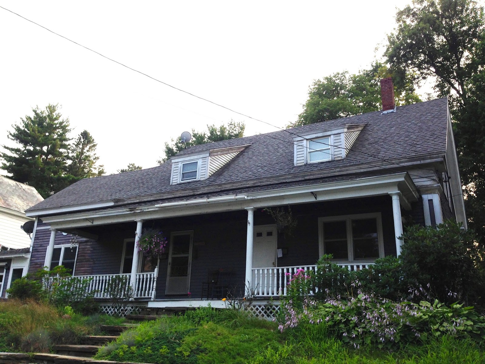
The mixed housing was interesting and old looking. Sitting right next to each other, these top 2 houses were as different as the colonial and trailer on W.Main.   They fall into the Orange Historic District though, so they must have some import.
Circa 1866-1867, a local business man, Stephen French bought a much smaller house at an auction.  Five generations of his family lived here: his mother; he and his wife; their daughter, Grace, who married Fred Weymouth; the Weymouth's daughter, Sibyl; and her daughter, Ann.  By 1868, Mr. French had expanded the small house into a very large one of 24 rooms.  Some years later some partitions were removed leaving 18 rooms, in the house and the three story barn. 

"Also of note are a three story brick mansard roofed house with asymmetrical plan (c.1865)," the question is which one of the few I saw were they referring to in this report I found from MA Historical Commission.

Some History: When the parishioners of the First Universalist Church of Orange began worshipping in the South Orange Meeting House in 1834, they shared the property with the Baptist and Orthodox churches. Funds to pay for the construction were raised by the sale of pews. In 1837 grants established the north part of town as North Orange and South Orange became simply Orange. In 1851 a group of regular churchgoers drew up a request to organize a Universalist Society which was formed in November. 

Have no idea what this rock signifies. It sits between the Universalist Church + the Orange Hx Society.

This is also lower 4 North Main St., across the st. from Town Hall I think it all belongs to the same Visitor Artisan Gift block that is around the corner (or at top of next picture).

 The 15-17 East Main Yellow bldg. houses Dial Self, a a community-based non-profit agency that has been serving the youth and communities of Western MA since 1977. I inadvertently captured some youth. I was pleased to see these few "Stop the Pipeline" signs, as Orange is one of the proposed towns it would pass through.
Heading up East Main St. toward the center there are a few commercial industries operating. Highland Spirits on the left and at the corner on the left is an outdoor outfitting outfit sort of store. 
This imposing factory at rivers edge is along the East side of the downtown and manufactures gates. The Rodney Hunt Company was founded in 1840 and produced the wooden water wheels and the sluice gates used in textile mills; later they would go on to make pumps and hydraulics. Located at 46 Mill St., it is still in operation, now called Rodney Hunt-Fontaine Inc. An article in local paper 2012 said co. was up for sale. Wonder if it is a stable economic base for this poor, poor town?

Along East River St., almost directly across from the new Peak Paddle Expeditions, is this old blacksmith shop from the 1820's. More about it here:
http://www.nystromsblacksmith.org/


 New (2013) mixed in with old. This was my destination for a late aft./early eve paddle. Boathouse built by local Vocational High School Students, it is a sweet spot (even if it was built on a former brownfield site).
http://www.peakexpeditions.com/the-boathouse/

Another curiosity. Looks abandoned, but see the little sign above the door? Well here is the facebook write-up found for 61 East River: 

About

Description
we are a full service gun shop specalising in personal defence and tactical gear. also ammo of a verity of calibers and weights. If we dont have what you are looking for I can order it from one of our venders. I also do firearms transfurs for a small fee so if you buy a hand gun out of state just have it sent to me and I can do the paperwork for you. now offering a firearms safty class to obtain certificate for your class A , B , or FID card. the class is taught by a NRA and Mass state certified instructor.

The grammar alone was frightening to me. Other businesses also comes up for that address, but still not a match to the main sign. Dexter Innovative Solutions + Echo Industries Inc.
Dexter has this lovely webpage that just does not match the facility. http://www.dexter-is.com/hammers.html

I could not find the history of this site. I did find other grim tidbits or factoids like this: In a study of the nine-town North Quabbin Region, the largest percentage of adults over
25 without a high school diploma live in Orange (20.4%). From a 2008 study of the town.

Between South Main St. + the Miller's River is a little block of brick + I just adored this wrought iron structure to cover a gap in which on could fall (+ perhaps someone did before this cute ornament was made) straight down to the tracks below.
The R.R. seemingly ran right thru the center of the new downtown Industrial Orange. There was an East-West corridor along the river in 1848 (Fitchburg R.R.). This R.R. devo'ed in Northern MA straight on thru to the infamous Hoosac Tunnel in North Adams. There were so many offshoots, charters, and mergers it is hard to say what came thru, or what is still coming thru today.

But I did find this current photo:
Looks like Conor G. has his R.R. geek on. Thank you Conor for answering my ?
An early morning late 22K roars through Orange, MA with an NS GE Widecab, and two SD70M-2s, one of them belonging to CN Railway
Railroad: Norfolk Southern
Locomotive #: NS 9318
Train ID: ST 22K
Photo Date: June 06, 2014


My second favorite (of course Mill is #1) street to find when excursioning! River would be 3rd choice.


Love when communities can involve youth in projects they can see and be proud of. Right on Orange, MA, right on!
My final chunk of pictures are of the unique homes I stumbled upon in the West River area. It looks like an old, yet vibrant neighborhood.


 These homes must have belonged to the executives of New Home Sewing I am guessing. The one below is right next to the old Mill complex. However, the third picture down has a plaque which is circa 1802, so I am puzzled. In 1802 most of the town was centered in North Orange and was agrarian. Perhaps these homes were for the earlier Textile Mill owners?
From the MHC Reconnaisance Survey of 1982 found this:


 Greek Revival was apparently in during the early to mid 1800's. pre-Victorian era of the later 1800's.
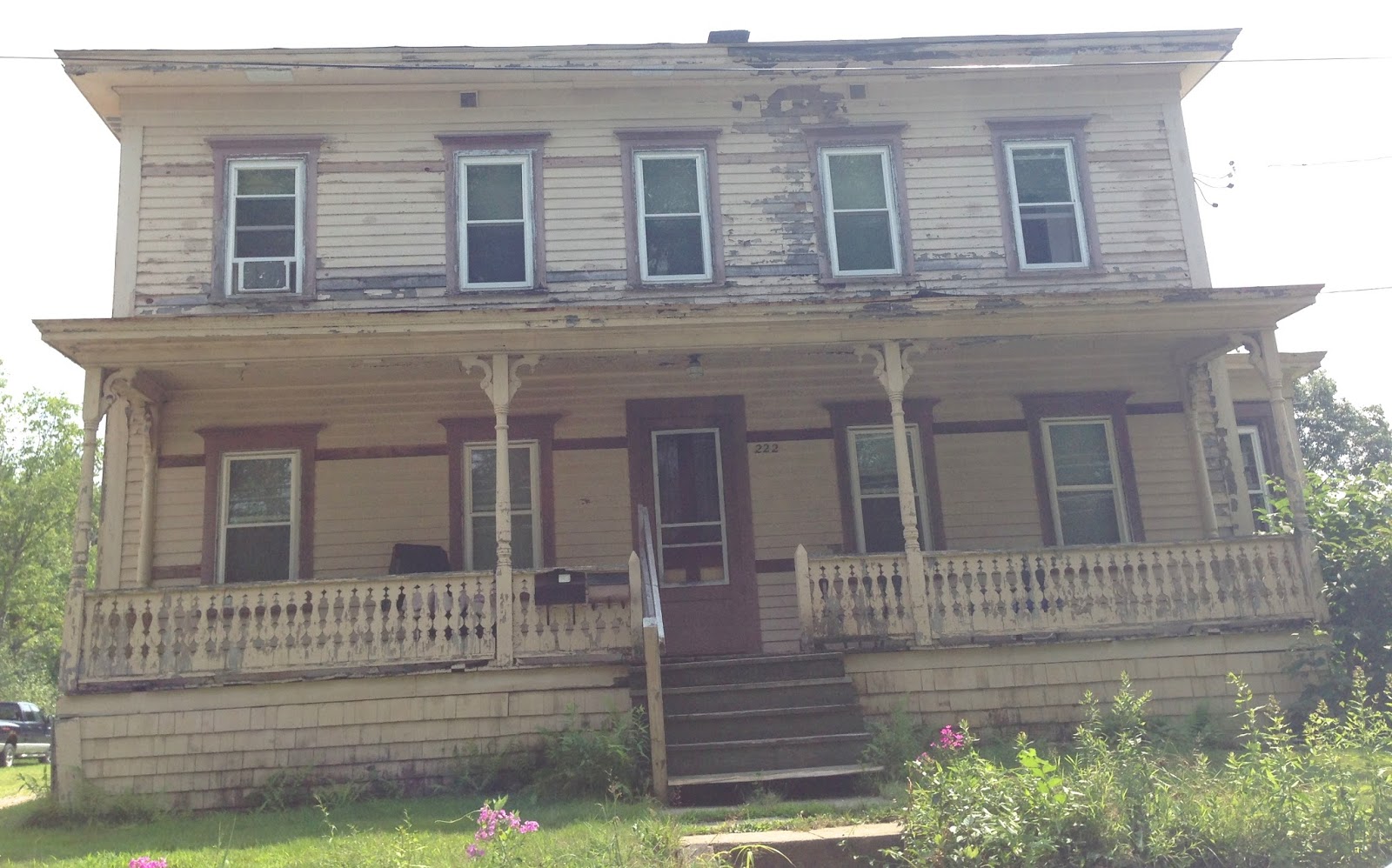

Once proud and predominant it is so hard to see these houses in faded glory.


When did corrugated metal become big? It looks like it came and went from West River area of Orange, MA. Of the signs that hadn't rusted beyond reading, I found Sakrete (1936 pre-mixed concrete packages) but not operating in Orange anymore.

In Orange in 1855, the 2nd largest industry was in chairs and cabinetware, so lumber was definitely a commodity. I just couldn't find out when it went out of fashion, faded and folded as several did even in my lifetime down in the Noho area. Home Depot and the big box were killers. Well at least this old bldg. serves as a place to advertise for the church down the street. 

Another faded home. They look tired and this one is definitely sagging.

Even the sign looks old! I wonder about the name Putnam though as the hx'ic Putnam block in downtown and now this street. Putnam is one of those old Boston Brahmin names.

 This Victorian Stick Style house on the corner of Putnam and Pleasant I think has an additional sign designating it as a "Square." I could barely make out the name, Henry Damon, I think, but could not find out why these squares were named. War vets?
These signs clearly were important to someone at one time, and were reently marked for the 4th of July, I just could never find any explanation.

This cute, simple stick construction home also had a time placard on it, I think the date was 1810. I thought it was adorable.

 This little side bisecting street I think says Bangs Ave.
 This well cared for Neoclassical Italianate  was elevated by a lawn on a little hill. Wonder if that meant anything?
And finally, the only double or "Mill type" housing I saw all day and it was inadvertent as I wended my way through this old neighborhood back towards a main thoroughfare. I wonder why I didn't see more of this? Was the town's mill workers  wealthier than in other towns? Was their company housing? 

I totally enjoyed my early evening paddle on Orange's Miller's River, and as well, enjoyed excursioning around towm before our paddle began. Definitely an old mill town struggling to stay alive today and into the future. I wish them the best of luck.

Friday, June 27, 2014

Cooked in Cokedale, Co 5/22/14

I never expected that I would travelogue blog, but it seems I now have this thing called shrinking memory going on. Like I know I went to the titled spot only a month ago and yet, it is like a fading screen at the end of a movie. How could that be? It wasn't that long ago. Glad I made my little collages with my nifty technology! So I can plop them here and re-remember. So here it goes:

Oh, and before I forget, I have to reintroduce why we came to this place. To quote myself,
    "We were looking for The Cretaceous-Tertiary Boundary in the Raton Basin Area of Colorado.               More specifically, we were going to try to follow some Geologists field notes from 1990 to                    Cokedale, Co to find and dig into and haul back...YUP, haul back rocks from the K-T boundary
   that allegedly circles the earth, but is only visible (and digable and haulable) from a few rare spots."


And I bet you are wondering what happened next, right?

suspense is mounting! or does it build? well anyway, here comes the next collage!
But, and yet...Where is it? Oh where oh where could that K-T be?
It was rather spectacular and not over and not under- whelming, and I even climbed up to take a look see (and of course my own little piece of rock vs. Peter's stuffed to the max backpack). I of course all the while had my eye on visiting that "National Historic District" that was on the first sign.
Top left is the remains of the ovens that cooked the coke, right= the sign that may have been indicating the size of the Historic district, and the speed limit surely bespoke additional information about the place (in fact, one of the 228 residents yelled at us for driving 16 in their 15 mile zone). The fire hydrant, well that was purely for my own edification/collecting of fire hydrant types and locales. This here Waterous hydrant, claiming to be around since 1886, was not a Spfld. MA Chapman Valve job. In March of 1991, the management of American Cast Iron Pipe Company made the decision to merge its two valve- and hydrant-producing subsidiaries, American-Darling Valve and Waterous, into one division. This new division became American Flow Control. Thus was born one of the largest and most diverse valve and hydrant producers in the world. This merger produced a division with over 200 years combined experience in the design and production of waterworks and fire-protection products. Production facilities are located in Beaumont, Texas, and South St. Paul, Minnesota. 
This small little town was once a mining camp, then company town founded in 1906. At it's peak (1909) it had a pop. of 1500, There really was only 2 main horizontal roads with only another couple of vertical shorter roads, but these little alleyways were interesting. It makes the term "gossiping over the back fence" seem apropos. Before the motorcar travel back and fro from Trinidad was by Trolley, cost $.25 + took 1.5 hrs.!

This area was like a place time forgot on the edge of...of...like far out thereness. There was a former rugged wild west and now just barely tamed feel to the whole place. Like the lower right side picture is, YES- an outhouse. Hopefully there as decorative amusement, but we didn't know. I think the top right was the former doctor's house, which as you can see by comparison to the house on the lower left was quite the house! It had steam heat and indoor plumbing.

It looks like these coal miners were proud people. And hard workers with hardscrabble lives. By 1909 the town was cooking! Each day it's #1 mine produced 1,500 tons of coal a day and its 350 coke ovens produced 800 tons of coke. Mining operations at Cokedale continued for 40 years and produced over a million tons of coal. 

Unlike other mining communities in the state, which were abandoned when area mines closed, the residents of Cokedale had the opportunity to buy their homes and with the same community spirit incorporated their community in 1947. The miners and their families were offered the homes for $100 per room and $50 per lot.  Here are some of the homes as they look today.

Some homes have been refurbished, some not. These would be the nots.

The famous and historic Gottlieb Mercantile Company building once sold goods to miners, now houses the mining museum, the post office and town hall! And we can't forget about the huge park that runs along the side of the building.

More historic buildings. Top left is front of Mercantile Co., top right was the 22 room boarding house (bachelors pads). We are unsure of the fancy house bottom left, but may also have been the doctor's house, middle picture next to wood sign is the mining office, and the bottom right was the schoolhouse and in the far distance of that photo was the church.

It was one of the coolest things to stumble upon this piece of Americana. To actually be able to see, read, and learn about the coal mining history of the area was an invaluable tourist treat for this traveler. Another awesome journey into the heartland (or wee corner, or tall town at 6332 feet) of my country.

Saturday, June 21, 2014

Leaving on a jet plane.

I didn't make it out of my Colorado journey in my head or on my travelogue blog (which this is turning into) before more violence and tragedy struck. Hard to stay focused on the positive sometimes when shit happens. And shit happens every day. Let's just rip some headlines here for a quick minute:

http://www.ajc.com/news/news/man-shot-at-oakland-city-park-on-fathers-day/ngLkN/

Police identify man shot in head near Atlanta park


Frances Jamaal Edmonds, 21, of Atlanta was the victim. Yup, dig the name, make the connection. I did when my cousin posted on fb. 
At approximately the same time on Father's day I was at another park, Savoy Town Park honoring my dad by doing this:


I don't know how to describe the odd feeling that comes from hard news, except to say that I called my 21 yr. old and DEMANDED to know if he was in a park in Holyoke or Springfield, buying drugs, hanging out etc. "Chillax," he told me. Chillax, I try, believe me I do. 

Then this a.m. more news about a park I had finally made it to and was awed by, Red Rocks Park a mountain park in Jefferson County, Coloradohttp://www.9news.com/story/news/local/2014/06/20/report-of-shooting-at-red-rocks/11033715/

3 people shot at Red Rocks


And once again we'll return to my hometown for the latest:
http://www.masslive.com/news/index.ssf/2014/06/football_coach_murder_victim_1.html#incart_2box

Football coach: Murder victim, 18, looked forward to college, leaving Springfield

They scream; headlines, they do. They shock and awe. They fucking suck if you asked me, and I know that noone has, but it's my blog so I can scream back:

THESE KINDS OF HEADLINES FUCKING SUCK. 

DOMESTIC GUN VIOLENCE SUCKS. 

YOUNG BLACK MALES DYING FUCKING SUCKS.

There, now I can feel a bit better. 

Now where was I? Oh yeah, on the road in Colorado. Moved out of Denver heading South. We knew this much: we were going to the National Parks in the 4 Corners Area. In order to tip into Utah, we had found a sweet location at a Ranch in the Canyon of the Ancients. Our Cowboy Cabin was inbetween Hovenweep in Utah and Mesa Verde in Colorado. But that was Southwest, and another day and another story.

In the interim time of planning our trek, the Geeky Pasty White Guy I love so much came up with his very own side trip. That's why we were heading South and not Southwest. We were going on a mystery hunt. You see, I plan and like to go see discovered and easily found stuff. No, not the pasty white guy. He likes to hunt for almost impossible stuff to find. And yes, this side trip was one of those hunts. Of course I have to go, it's only fair. He is so agreeable to my EASY trips. So what were we doing heading South?

We were looking for The Cretaceous-Tertiary Boundary in the Raton Basin Area of Colorado. More specifically, we were going to try to follow some Geologists field notes from 1990 to Cokedale, Co to find and dig into and haul back...YUP, haul back rocks from the K-T boundary that allegedly circles the earth, but is only visible (and digable and haulable) from a few rare spots. 

What I did not expect was to fall in love with the area. Trinidad, Co was a funky little town with its own violent history and even a Trinidad War!
As we exitted the highway, the scene wasn't too pretty. In fact, it was run-down and desolate. More coalfield has-been. The region was booming in the late 1800's and early 1900's, but by about the mid 1930's the growing use of other types of fuel undercut the need for coal. Many of the coal camps folded up, and the area we exitted into was on the outskirts of town and very run-down.

Trinidad itself was once a Mexican territory and a part of the Sante Fe trail that folks used to head to the Southwest. About 8,000-10,000 yrs. before this however, the earliest Indigenous settlers, the Folsom, lived in the region, then later many different tribes made the plains their homeland, and finally the Utes and Apaches. Eventually the situation changed, and the story sadly ends with the forced removal of both groups to other places as the Anglos moved into the region, homesteading and setting up ranches and farms.

This once grand dairy farm can be seen from the highway, and at first I thought it was a mill. We went through the run-down little area above in search of the big brick structure and then found this. When we asked in town we were told it was The Bowman/Petramala Dairy, 1910 - Built from brick and based on plans for a Pennsylvannia barn, was first owned by 2 sisters who homesteaded the property in 1881, then sold to Harry and Mary Bowman who built the barns and delivered milk to the coal camps in the area. It was later purchased by the Petramala family who sold the milk in bottles to the Trinidad population.

So instead of the right turn off I-25, if you turn left you come into downtown Trinidad! Population of approximately 9,000, it was the regional center of the coal camps in the early 20th century. The top aerial view of the brick town also shows Fisher's Peak, a National Natural Landmark, is seen in the background. There is a huge 'Trinidad' sign on this outcrop that can be seen for miles, but not from our view. We didn't have time to take a trolley tour :( But we did get to drive thru town, stop at the museum store (of course to buy books, why else stop), eat lunch and then be on the road again. The bottom two photos are of the West Main St. section. More on that later.
Upper right is the approximate area where the U.S. Army marched thru in 1846 (Trinadad was still a part of Mexico then). Lower left, the "Other Place" is a bar at the corner of High and Main. Not exactly sure, but this may be the split of  Main, from West side to East Side. The street, like the population is split, about half Mexican-American heritage, and the rest Anglo of mixed descent as the region became more populated by different European immigrant groups.
The top left in this collage shows what Trinidad looked like in the early 1900's. This was also where in 1914, the NYT headline screamed:

 "State Troopers Seize Her on Her Return to Trinidad"
The local story paper reported:

"MOTHER" JONES ARRESTED
TRINIDAD, Col., Jan. 12-"Mother" Jones, strike leader, who was deported from the Southern Colorado coal fields Jan. 4 by the militia, returned to Trinidad this morning from Denver. As soon as her presence was learned by the military authorities she was arrested and taken to the San Rafael Hospital, where she was held a prisoner and was permitted to see no visitors.
She left the train at the outskirt of Trinidad and later appeared at a local hotel. She was arrested by a detail of State troops, hurried out of the hotel, placed in an automobile, and whirled through the streets with a cavalry escort galloping at full speed in front and behind the machine.
Several hundred coal mine strikers lined the streets and cheered wildly while "Mother" Jones waved her hand in response.

She was there to support the local coal miners in their strike against The Rockefeller + Gould Corp, CF&I. Once called "The Most Dangerous Woman in America," she is an idol of mine. Her words,

You ought to be out raising hell. This is the fighting age. Put on your fighting clothes.
                                                      -Mother Jones

The Trinidad Opera House, also called the Jaffa Opera House, is located at 100 West Main. The edifice was raised in 1883 and was built by Henry Jaffa and Sullivan Jaffa who were joint owners with Samuel Jaffa. The building materials are adobe with brick and stone facing. This building contains some of the finest incised sandstone to be found in the city. The city is very proud of this pretty building.

We were amused by the tractor slowly rolling through town (gives you an idea that farming may still be hapening on the plains). In the late 1800's, Trinidad was the headquarters for huge ranches. And yes, of course I found a thrift store, right across the street from the very cool lunch place we ate. I loved the old clock and chandelier.

The building above used to be Chappelle Mansion, part of "Millionaire's Row" It is now the home to Mullare-Murphy Funeral Home. The front says 1863, while the side view says Murphy 2003. Across the street was another mansion, The Bloom Mansion, now a museum and store. We got to talking to the clerk, and in the small universe in which we live, found out she was from Pittsfield! The bottom two showcase the town's revival as a tourist destination. The Purgatoire Trading Co. features Native Amer. jewelry and Western Art. Don't quite know what that means as we didn't get to stop in.

 As you headed to the West Main St. end of town, and its outer bounds, there was no Millionaire row.  It definitely was less gentrified and then as you traveled further out, there was a sense of old Hispanic settlement remnants as the top two pictures show (I love the top right picture, one of my best shots of the trip).  The HS is in the Western part of town as well, with this funky geodome gym. And then we were almost nearing Cokedale when we came upon the brown marker. But here is some history on the region before we go:


The first permanent settlers along the Purgatoire were Hispanic families from northern New Mexico. Some came with Felipe Baca, a trader from near Mora, who founded Trinidad in 1860, after he discovered the valley while taking a load of goods from Mora to Denver to markets that served the mountain mining camps. Others soon followed. Some scholars believe that the long isolation of the northern frontier of New Spain-Mexico resulted in a culturally distinct “Hispano Homeland,” (Nostrand 1992) wherein Hispanics whose heritage lies in this region (i.e., northern New Mexico and southern Colorado) are culturally distinct from Hispanics who are descended from Mexican immigrants or other Latino groups. For many years the Purgatoire region was largely Hispanic: The 1870 U.S. Territorial Census shows that of the 4,276 residents of Las Animas County, 78 percent were born in New Mexico, and many others had parents who were. It is notable that the 1870 census takers categorized these residents as ‘white,” whereas by the 1880 Census, Anglo-American census takers racially categorized the same people as “Mexican,” although this was an unofficial designation within that category. This conflation of race and nationality would be used to marginalize people who, in fact, had not moved across a national border, but rather the border had moved over them.  As Hispanic people moved into the area from the south, Anglo Americans and European immigrants moved in from the north and east. By 1880, at the apex of the first wave of settlement in the Purgatiore Canyon region, Las Animas County’s population had more than doubled, but the number of residents born in New Mexico had dropped to 44 percent, although Colorado-born Hispanic residents still kept Hispanos in the majority—in the Purgatoire Valley, Hispanics still comprised 58 percent of the population. The influx of non-Hispanics were mostly US-born, but of the 550 county residents who were immigrants, more than half (228) were English, Scottish, or Irish. Germans and other northern Europeans also accounted for a strong number of immigrants. But most of the Anglo-American settlers came from the Midwest or Mid-Atlantic states. 

Tensions between Hispanic and Anglo-American citizens were more often rooted in conflicts around economics or land usage than in ethnicity, and differences between sheep and cattle ranchers were not unheard of. The "War" was basically a race war that was fed by the prevailing attitudes of the time. According to the Beshoar account, it started with confrontation between “Mexicans and Americans” after a physical altercation that quickly got out of control, on Christmas Day, 1867.
Before it was over, federal troops were called in from Fort Reynolds (near present-day Avondale) and Fort Lyon. The war ended with the arrival of Brig. Gen. William H. Penrose and the Fort Lyon troops. “The Fort Lyon troops with three companies of mounted infantry and C Company of the Seventh Cavalry after a fantastic march 130 miles in thirty hours, in temperatures ranging as low as 26 degrees below zero arrived on January 5th. The troops left Fort Lyon at sundown Friday, January 3 and arrived at Trinidad at 8 AM Sunday, January 5th with half of the original complement of men and horses.” Gen. Penrose immediately put Trinidad under martial law and the Trinidad war was over; only the aftermath remained.
This entire incident is a very interesting bit of little-known Colorado history and Fort Lyon was a very important part of it.

Of course there is other deeper conflict and painful history in this area, I just couldn't re-visit. Kit Carson is all over this town. Trapper, Scout, Soldier- he is held up as a great hero and legedary man. There is a park, and of course a statue. His life as an Indian Agent is little mentioned, and when it is, they call him an "Indian Fighter," others see it in another way- "Indian Killer." He is vilified for his conquest of the Navajo and their forced transfer to Fort Sumner, where many died.

So as I leave this funky little place with it's own violent history, I gladly joined Peter on the more benign hunt for naturally occurring solid aggregates. Sometimes we just need to get back to nature, get inside something good and hang on for as long as we can.

I will go now and celebrate this longest day of the year, not of course at Stonehenge, but at an equally as spiritual a journey as I can take- over to the mighty Hudson for a lovely environmental and musical festival and a good nights stay on Bear Mountain in the Highlands of the Hudson.

Happy Summer Solstice All!