Tuesday, October 28, 2014

Have you ever tried to find a meteorite in a strewn field in western N'eastern Pennsylvania?

I have. And not only that, I did it in the midst of the falling fall foliage this past weekend. And did I mention I did it on a Saturday in the falling fall foliage in western Northeastern Pennsylvania, and that meant strewning about on State Game land in these very remote almost roads. And you know what was the only thing strewn about that we saw? Hunters and hunters lodges. Lots of them! And here's the kicker- we were traversing a strewn field that included dense forests that are not only concealing fallen star stuff, but also a cop killer who has eluded capture for the last 6 weeks.  Happily I can report that we did not find Eric Frein, and sadly I can also report that we did not find any meteorites either. But the trip was quite the journey.

First the fall. Not the season, the other fall. Someone (that would be hubby Peter) tells me excitedly, "There was a possible fall the other day in PA." That other day was 10/17 and  the exact location was unknown. But if you could've heard the tingle in his tone. Like the hunt was already on. We just needed the data points and the car packed and we were on it. Which is exactly what we did. Some dude does something with doppler radar to produce the points, which in turn gets mapped into this:


It looks so small and manageable from that silly little piece of paper. With two named places of Noxen, PA and Sweet Valley, PA now how easy is this going to be? Even unfolding a PA map and looking at the Scranton/Wilkes Barre area looked like a piece of cake to do.


Then of course the next step was to purchase an entire road atlas of Penn. and find the Northeastern page (42), which was this:
This is the western side of Northeastern PA. I learned something in looking at this gigantic atlas- PA was larger than I thought. I also learned another thing: The State Game Lands system includes more than 1.4 million acres. That means land is specifically set aside for hunting- a lot of land!  We were traversing the western part of the area, which meant we were roaming around in State Game Lands No. 57, which is in Wyoming County (the Eric Frein search was focused a few counties over in Monroe). This area is 36,506 acres small! We were only on the eastern side of this densely forested land. 

We began in the nearest town, Noxen. Noxen, PA is about a sneeze large. In my advanced strewn field training I had learned that you should be looking for dark, almost black (but not the anthracite coal that "fueled" this area's economy for a long time, nor the slag that was aplenty) rocks that stand out from its surroundings. The best way to do this is find open, paved surfaces. Well let me tell you, that was not easy in Noxen, PA. So what we did instead, was to drive slowly thru the town on its four or so streets (okay maybe it was a dozen). Here is what where we went:


We couldn't really drive thru this cemetary b/c it only had one road, but we could look down the rows.


See the color of the dirt road, this would be a good place to spot a stand out black rock if there were one, but alas there was not.


This is the old Noxen School Building and it is 100+ yrs. old. Restoration efforts have preserved it and it is now the towns multi-use bldg. It was our focal point as we circled around the roads, driving super slow and perusing the sides of the paved roads. We were mostly the only car on the road, excepting hunters who were on ATV's or in trucks as they wrapped up their days hunt. We continued ours.

Here's what Noxen has to say about itself:
"Built by the lumber and tanning industries in the 1800's, Noxen has evolved from a busy railroad hub to a picturesque residential community with plenty of history and small town charm.  Located in glorious Northeastern Pennsylvania, our town enjoys natural beauty while offering a central location from which to explore everything our region has to offer."

The population of the town is 633. There are two waterways that meander through the town, Beaver Run and Bowman Creek. We traversed along Bowman creek, where we came upon a small stock of old Mill housing, most likely associated with the Tannery that ran until the 1960's. Here is a full page article done on the scenic little town in 2001:http://www.noxenpa.com/CVstory.html


 Here is a typical average home for the area, complete with matching half bathtub Maria yard sculpture. We found much less evangelical christian markings in around the towns up North here as compared to when we were in Southern PA last year.
 It was odd to see this building just sitting unused in the middle of a family home to the left. It clearly was a train depot (built in 1893), although there were no tracks anywhere to be found. Indeed the Lehigh Valley railroad had a spoke that ran up to Noxen, but like the Tannery, this line stopped in 1961. Plans were in the works in 2001 to restore this structure, one of only 3 of that design still standing. It looks preserved, just not used.
 The town "square" so to speak, where the old Tannery baseball field is had a  GRAVEL (urgh, we hated gravel= too hard to search, but we did it anyway) parking lot and this large monstrosity, which is a spoke of the windmills that dotted the numerous mountains in the region.
 This huge home must have been something once upon a time. The Mill owner? The lumber king? It sits smack in the middle of the town between the other large bldg. that is now the Historical Community Center and the old RR Depot.            
This lovely tree in the yard of the big house yields round black-looking fruit/seeds that you see dangling from the branches in the sun's shadow.
 But these suckers are not black at all and we soon came to dislike them for fooling us as we traveled around that gravely lot.

Who remembers this? It is one of those things that causes you pause as you drive by someone's yard and look, as I do at their middens. Why in 2014 was it out there. Perhaps it was associated with the old schoolhouse next door and is no longer used (when did mimeograph machines die?). I so wanted to haul it into the car, but the terms austerity and downsize are my vernacular and mantra these days. Besides I figured we'd need the entire back of the SUV for the massive amounts of star stuff we were going to collect (ha!).


So after circling the town a few (or was it a dozen?) times, we cast a larger net and looked elsewhere in the strewn field. I was beginning to get a different sense of what strewn field meant.


 The geography and topography of Northeastern PA is mountainous with valley's inbetween. Similar to West. MA, but the hills are slightly higher. There are the Endless Mtns. (pt. of the Appalachian chain) in Wyoming County w/ an avge. ht. of 2500 ft.
Some scenes were breathtakingly beautiful 
 From Wiki: The region's economy was formerly based on mining, lumbering (especially of hemlock for tanning) and industry but is now largely agricultural withforestry and tourism contributing to the economic base. Much of the land is steep, but there are a few good farms on rolling hilltops or valley bottoms; many of these farms have been occupied by Mennonite and Amish people who have migrated northward as their traditional homelands became developed.
Quarrying remains an important local industry with the region's high quality blue stone being particularly valuable. The area is on the edge of Pennsylvania's Coal Region, with some minor veins of coal extending into the area.
Other scenes were obscenely ugly. We are pretty sure this is evidence of fracking.

NPR produced a fracking map of PA, and we were right in the spot that had the most violations. I know little of the life of the farmers in the area, or the hardships they must be facing, but is fracking really their only option? Such a bad thing for the environment. And after all the sad stories of the coal mines and coal miners lives. I wish I had a magic wand.
http://stateimpact.npr.org/pennsylvania/drilling/


Just barely caught this image, the farmer spreading manure. This is the valley in between the mtns. in the middle of the strewn field.


We meandered in and about roads and before we knew it we were in wooded areas again. We came upon this sign and got a bit excited. Schools have big parking lots in which to search. But alas, there was the sign, and then not a school. Go figure. Instead we meandered deeper into the woods and it soon was apparent that we were in the heart of hunting lands. Here is what we found in and near State Game Land 57:


We followed all 35 of the rules when we were hunting!
 It looks like Pittston Junction has seen better days! There was a significant amount of damage to some of the sites that were near the water. Some sort of flooding must have happened.

This one was a creeper (there were more than a plenty of similar ones)

The guys in Dickson City, PA may have died off?


It sure was! 

A few of the sites were old ruins:


 Some people way out here in the woods wanted to be left alone and they let you know it!
I imagine there are thousands of these places all throughout the mtns. in all of PA. Places a hunted man could easily hide in. I began to get really creeped out as dusk fell and was glad when we decided to call it a day and head back into civilization.
Happily a little critter made it through a day in hunting territory and was also headed to a safe haven!

We ended up staying in Wilkes Barre for the night. Peter thought it was a part of the Scranton area, I said it was a separate city, so we looked it up. With a pop. of about 41k, it is a small city w/ big city problems- huge corruption, terrible crime. It's only a night we said. It was scary in the woods, and scary in town. 
 I was pleasantly surprised to find an abandoned mill. I had the sense there were likely more of this as it is an area that has been depressed for a long time. 

I tried to pick a brick for my midden, but all were indescript and more modern'ish so I left them.


Oh to find flora among the decay always makes my day!


And some old mill housing on our ride out of Wilkes Barre on Sun. morn was a treat.

We started Sunday morning off at a place called Harvey's Lake. We were now in Luzerne County (now only one county away from the manhunt in Monroe). The lake within the borough is the largest natural lake by volume contained entirely in Pennsylvania (it's about 648 acres), and has a pop. of about 2800. We circled the lake, hitting as many parking lots and streets as we could find before we headed back into the woods.
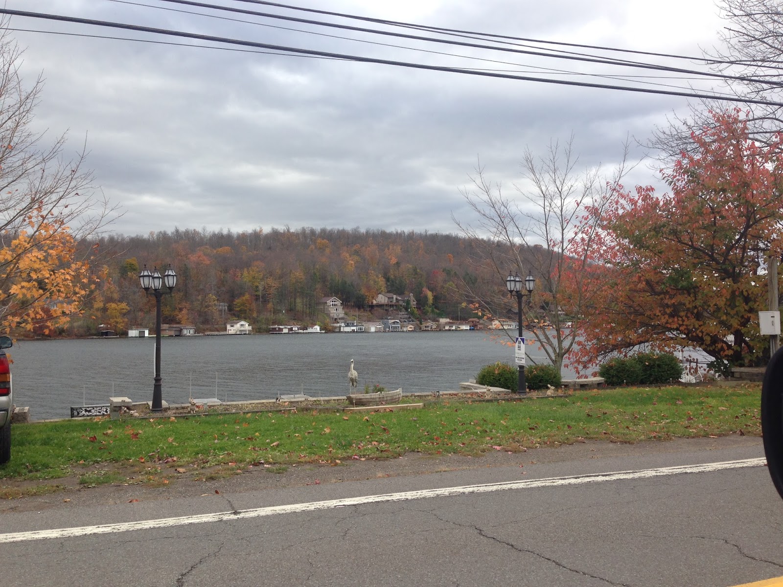


 This cute little cottage was creative with it's vegetation in the guardrail. 
I thought it was a very cute and creative idea.
 Harvey was Benjamin Harvey, who founded the borough in 1781 and was a member of the Sons of Liberty, an eminent colonial-era group that eventually defeated the notion of Great Britain's Stamp Act.


 I was intensely interested in the following two structures. They appeared to not be in use.
 Come to find out they used to be a part of an amusement park on the lake called Hanson's. This site opened in 1891 as the old Lehigh Valley Railroad Picnic Grounds. Early attractions at this location included a carousel, bowling alley, dance hall, a small roller coaster and an arcade.
The Hanson's purchased the park in the 1930's and they had a 40+ yr. run before interest and attendance at the park declined. It finally closed for good in 1984.


 The beauty of an Autumn day out here in N'eastern PA was breathtaking.
Peaceful beasts on a small farm.

Next foray into the woods was more hunting places, plus all the beauty along the meandering Bowman's Creek. We actually even managed to end up in an actual Park (not hunting land) on the tail end of our day- Richett's Glen State Park. The flora was so pretty.


 Bowman's Creek
Here is the wiki info on this winding creek that we repeatedly ran into and across:
Bowman Creek is a tributary of the Susquehanna River in Luzerne County and Wyoming County, in Pennsylvania, in the United States. It is approximately 26.4 miles (42.5 km) long and flows through Ross Township and Lake Township in Luzerne County and Noxen Township, Monroe Township, and Easton Township in Wyoming County.[1] The watershed of the creek has an area of 120 square miles (310 km2).
Such beauty! Yet, we saw the ravages of what happens when flood waters breach their normally tranquil bounds.

Also, we saw this, which we ourselves weren't clear on. Is it Bowman or Bowman's?


We were unsure of what this was just sitting in the woods, but then a while later we saw this:


We figured it had to go to this bridge. I wonder if there was once a rail trail thru these woods?


We saw so many of these upheaved trees along with the ruined lodges and cabins.

The following were stone ruins that seemed somehow older than all the others. I wish I knew what they were.


We came out late afternoon at Trail's end.
Where we at a late lunch and admired the decore:


Finally we then headed down to a final sweep of the southern end of the strewn field (which meant we were now down to the possibility of tiny pebbles if we were to find anything), which was out Rt. 487 + 118 and then along Main Rd (and a few ancillary roads) in Sweet Valley. We found this along Rt. 487:


We stopped in and tried to get employed, but it didn't work. I think the sign is then false advertising.


The center opened in 1978 and uses the buildings of the former Benton Air Force Station, a Cold War radar facility which operated from 1951 to 1975. Red Rock is on Pennsylvania Route 487 (PA 487) within Ricketts Glen State Park, and is still the site of a Federal Aviation Administration (FAA) radar used for Wilkes-Barre/Scranton International Airport.
Hard to find information on this place. Was once two towns then combined into one and the name is related to the presence of many Sugar Maples in the area. 
Sweet Valley is not a municipality, but only a village in Ross Township.

The housing stock varied widely. A sampling:


 This slab sides house won the award for "cutest."
 Another spooky abandoned house. Apparently many towns up here in N'eastern PA have this problem as we saw these type of properties everywhere.


The foundation on this hillside place looked to be very old and the home above it made (cheaply) much later.


This old abandoned building is an                                                                                                              old school
 The sign says Mott School

This is my favorite abandoned farmhouse building. It was at the head of a field of corn. It is a building of the corn. It could be made into a sequel movie of the Children of the Corn or maybe it would be a prequel.


Sweet Valley is not a municipality, but only a village in Ross Township. Despite this fact, we observed the most businesses of all the places we visited in the strewn field areas.

Need a hunting stand? This feed store had not one, but two to pick from!


Notice something about this large parking lot? If you guessed it was a brand spanking new BLACK tar lot, than you'd be right. And all the businesses seemed to have been hit by the same company. And black new tar parking lots are almost impossible to hunt around in, but being the troopers we were, we hunted anyway.


We read about this phenomenon happening  around the area d/t the extensive manhunt for the cop killer, Eric Fein. However, it felt a bit hypocritical to be having a celebration w/ Pagan roots.
Final hope and stop was at the elementary school with the biggest parking lot of them all. Alas, in the end we were unsuccessful :(
But we sure did have a wonderful adventure and I learned a lot. Searching for Star Stuff in Strewn Fields Suits Peter and I just fine! I can't wait for the next fall.

Parting chunk of shots is of the human elements involved in the hunt.


This was the best meteor-wrong. Peter was kind and didn't tell the man who had it so though. He carefully unwrapped it from his well concealed paper and proudly showed it to Peter.

 This also was a meteor-wrong,  but look at how delicately  Mtn. man Peter holds it out for examination.
This was the common stance of the weekend, more from Peter than I.

Somewhere in there is a beautiful black rock just waiting to be claimed (just not by us on this day).


And finally the time lapses, which I thought were absolutely hilarious!


Sunday, September 21, 2014

Finding Floydsville, Ct. 9/14/14

So why would I want to find Floydville, Ct.? 

A lovely fall Sunday and cemetery visit to my own relatives in Suffield, Ct. turned into a serendipitous find. But the odd relatedness of it all makes random sometimes not feel that way at all.

Here's how the story unfolds: I recently learned that the reason my father's family had fallen off the genealogy chart for 1930 was because the census taker/recorder had put them under Edmunds vs. Edmonds. The family shows up in the 1920 census as Sam (27) and Magnolia Edmonds (21) with 2 children, 2.5 yr. old Anna (my godmother) and 8 mth. old Doris. They are renters on 21 West Suffield Rd. and Sam's occupation is listed as "farm laborer." The listing also tells of the neighbors also renting on West Suffield Road and the first 15 names are all from Poland, then the 4 negro's from Virginia/Edmonds,  and finally, curiously, 4 other Negros with the family name Davis from Maryland (they coincidentally are a 37 yr. old mom w/ 3 children and no occupation). Most of the occupations of these 1920 West Suffield renters are either Tobacco Warehouses or Tobacco Sizers. 

I would so love to have just 5 minutes (I lie, I would be greedy and want at least a week) to gaze upon this scene of Polish immigrants and Southern negros all living and renting in the rural Northern Ct. countryside in 1920. What ever would it have looked, smelled, and felt like? 

And then warp 10 years. Lost in ephemera, but existing none-the-less, for I have dad's birth certificate and sure as shit the man was born on May 4, 1924 right there in Suffield, Ct. But they weren't in the census. They disappeared. "Well his brother James was 33, and a truck driver who lived on Russell Ave.," the person at the Hartford Historical Society told me (I was on another journey to visit the mansion that housed the society and for ha-ha's I stopped and asked). "But apparently Samuel moved away." "Nope, not true" I stubbornly retorted, "They were there." I was sort of reeling from the 1920 news that my father had a sister named Doris who also really, truly did disappear. Never a word had I heard about her. She was there in 1920 as an infant and gone in 1930 when we did finally find the family as Edmunds. What happened to her? How could she just disappear? The census had the family now moved to 98 Depot Street with a full compliment of 8 children, excepting when you compared the children of 1920 to 1930, there is 12 yr. old Anna, and then 8 yr. old Matilda, and on down. Doris should have been 10 and in the line up, but she was a gone girl. Talk about a mystery.

Samuel Edmonds et al. got misfiled, lost a daughter, and when we went to look for this 1930 census address in West Suffield, we sadly found that Depot St. did not exist anymore. Tobacco barely exists anymore in Suffield, and back in the day, well Tobacco was King! Since about the turn of the 19th century tobacco was the industry and in 1810 West Suffield boasted the 1st Cigar Factory in the U.S.  Just let this stat sit for a moment in your head: By 1924, there were 15,000 acres of tobacco being cultivated under shade in the Connecticut River Valley!  

In 1902 a railroad line was run from Tariffville (currently Simsbury, Ct.) to Feeding Hills, passing through West Suffield Center. This is the area that still has shade tobacco growing by small farms and also the area that the biking Farmington Rail Trail goes thru. This line was not the same as the 1844 Hartford-Springfield railroad line with its branch to Suffield that was completed in 1870. Also, Suffield had 2 canals, one on the Ct. river side, and the piece of the Farmington canal that went straight thru on up to my current location of Northampton, MA. But finding out information about West Suffield has proven to be quite the challenge. I dig a little deeper each time I go to the cemetery and feel stirrings of curiosity and connectedness.

Finding Floydville, although accidental, sort of provided a context for what I imagined of my own family, but just down the road a bit. 

This re-used station depot isn't even on a Depot Rd. It is on Hartford Ave. in East Granby, Ct.
This is what the East Granby Station originally looked like.


This partially shaded home is abandoned, although the cars that dot the property don't look that old. This is a slightly elevated road that runs parallel to the Rail Trail for a short (like only 3 houses on it) while. We learned that this street was named...Railroad St., how aprophos, right!?
I bet I know someone who could carbon date those Converses to an exact year and model!


My good ole Pet(er), rule-abiding citizen took distant shots.

Overgrown and in a state of decay is this once proud church.


Yes it looks like a ranch style house, or at least that it started as one and was converted.

It is just sitting on the side of the rail trail and one has to wonder, "why?" Why left to decay, why no explanation.


The windows had what appeared to be almost like those plastic decals, but with a church motif.

There was scripture stuff written on cardboard and propped against a wall inside.

Old boxspring mattress and luggage littering the yard


and something once proud, now a hazard and a mess. Such a sad shame.


So what is all this, what happened here? 

Took some digging but I eventually found out (or at least part of the story). It's here:

http://ctfreedomtrail.org/data/files/CFT%20Shade%20Tobacco%20updated(1).pdf

Thank you Dawn Byron Hutchins, Ct. area historian for providing great stuff for curious minds like myself. Rushia West's story is such an amazing one.

From Dawn's work on the tobacco industry in Ct. is gleened this:


And then Rushia West's story begins when her family came to Ct. from Americus Georgia in 1917. The church was called West Church and it was built by Rushia starting in 1955 to serve the tobacco workers in Floydville. The story ends, "By 1990 Rushia West had passed and along with her the memories of the community she built." What then happened is lost to me. No one cared? Tied up in litigation? All I know is what we stumbled upon almost 25 yrs. later. Rot and decay.


There was a house, there were cars, there were pleasure crafts (boats), and some looked fairly new. But all was just sitting there.
I wonder for how much longer?
Somebody's Couch
Then we came upon this house near the end of Railroad Street. I could hear children playing somewhere in the yard, and I soooo wanted to stop, knock, and ask. Alas, there are those things you just have to let go.

Tobacco sheds and a tractor sign near Floydville Rd. tells a story in and of itself
Even if the sheds have seen their day. Tobacco is still here, just not King anymore.
and then there are the next 2 pictures (which others have tracked + blogged about its decay) of the remains of the Floydville Plantation.
Hard to believe that up North there were "plantations," but there were and there is even a Plantation Dr. in Suffield, and Plantation Rd. in  Windsor as well. This term "plantation" was associated with the tobacco industry and this site was originally a part of the America Sumatra Tobacco Co. The area was + is known for growing "shade tobacco." Makes sense that some Southern blacks made their way North to these Ct. outfits as they came from tobacco-growing regions in the South. Some folks were recruited as was the way for many types of booming industries at the turn of the 20th century. Marcus Floyd was one of those recruiters, and thus Floydville Rd. and plantation came to be. Looks like soon though, it will be no more.
Some things I learned about shade tobacco:

  • Ct. River Valley known for this type of growing as well as being used to wrap cigars.
  • Relies heavily on migrant workers from South and Caribbean
  • Famous folks have worked up here like Arthur Ashe, Mahalia Jackson, Hattie McDaniel and Thurgood Marshall
  •  The Connecticut River Valley was immortalized in the 1961 film Parrish, which starred Troy Donahue as an ambitious young man trying to make a living working on a Connecticut-shade tobacco farm. An evil tobacco baron played by Karl Malden gets in his way.
  • There is even a museum, The Luddy/Taylor Connecticut Valley Tobacco Museum in Windsor, Ct (that I hope to someday visit).

Couldn't find out what this brownfield site was. It is diagonally across from the failing plantation and directly across from Railroad St. Next door is some sort of tree farm on Lordship Rd. (who comes up with some of these street names?).

So we rode on thru to Simsbury, Ct and then returned to East Granby, Ct., having learned a little of what it must have been like to come North to work at the hard manual labor task of tobacco worker. I signed on to do just that as a teenager and was driven somewhere down here in Northern Ct. and guess what? I didn't even last one day in the horrid heat of the fields. I quit mid-morning, ate my lunch early, and sat for hours in the bus until the migrant tobacco workers day was done.

Tuesday, September 9, 2014

Heritage Tourism: the quest fоr things historic by well-heeled tourists.

Yes I borrowed the part of the line (from the NYT), elevated it to a title and am now calling it my own. It so described my journeys, I just had to have it. That it was in the New York Times as а new travel phenomenon, makes me un-unique, something we all want to be told on a regular basis. That there are about 7 billion humans and growing would sort of give one the sense, and yet we forge on as if...

Hello, you are not alone. But still, the desire to go out and look at other people's stuff, mostly their decaying historic shit, puts me in another category- some may call it weirdo's, but there a plentitude of other titles and blogs for what we do. I call mine walk-about's although at times this is even a misnomer, as it is more like drive-by's, which this one most definitely was.

Deep traveling, or traveling "on the hunt" means I am looking for rust. decay. rot. broken windows, and blighted blocks. The first sign usually is tall, brick, with broken windows. Then I off-ramp it and wend my way towards the structure. All the rest unfolds along the hunt. The pathetic Main St., in this case what little was left of Main St. Worn down looking people and a first- a motel advertising rooms available in an empty facade. A town that now can only really hold up one thing, the glory of an aged actor named Kirk Douglas (whom now has a park and a plaque).

I am talking about Amsterdam, NY. Accessed of Interstate 90, on the "Rust Never Sleeps" non-musical tour (yup, I borrowed that one too from Neil Young) to Central NY.

What I saw from the highway was a huge factory complex with "FOWNES" in large white capitalized letters. So I exited to have a look-see. Fownes was a glove factory once upon a time owned by brothers, which later also became known as the Mohawk Carpet Mills. It is a 6 story building built in 1926, which in my mind makes it a not very old applied masonry brick bldg. Some would call it early modernism for the type of factories being built in that era. I call it boring and ugly. Sorry Fownes.

Apparently Amsterdam was once a huge carpet manufacturing town and Fownes came about as a later entitiy. By the turn of the century there were mills in the Church St. area, down near the RR (the lower mills), namely the Sanford Mills. 

This article gives a nice little synopsis of the later mill history of Rug City Amsterdam:
http://www.dailygazette.com/weblogs/bcudmore/2010/aug/30/83010_cudmore/

I found it mildly amusing that once upon a time the Yankees had a farm team named The Rugmakers!

Also somewhere in that article is the line, "but eventually manufacturing moved South...labor was cheaper there." Can you hear the death toll bells? I can. I saw. Death and decay. Not quite death but dying a slow death I'd say.     

But wait a minute here. I know I saw the Mohawk River and many names that had Native American roots, but when I tried to go to the "Indian Museum," guess what? It too was closed, like in permanently. So once again I hit the internet to find out:
http://www.amsterdamny.gov/visitors/about-amsterdam.php

So Indigenous, then Dutch, then Anglo, now polyglot. A rise, a fall, and a renewal (attempt, not going so well by the looks of it). It is the American Mill town story, told over and over and over again as I visit both large city, and small hamlet throughout the Northeast, and here in Central NY. Urban renewal and the splitting up of and destruction of a downtown. The seal of disapproval I say is the destruction of a community's downtown.

Anyways, here is my Amsterdam NY walk-about: