Now isn't that a big statement, "Indian Territory"? Who came up with this term? Invaders? Immigrants? Interlopers? And what exactly is this territory that is referred to by the Federal Government, Settlers, Cowboys (and I'm sure a few cowgirls too)? I bet if you asked a Native American, they would say this whole country is their tribal lands, and that would be speaking truth to power. I wish it was as simple as that. But it is not.
Another situation in the good 'ole USA, similar to slavery, in that the situation and the territory as defined by white folk, were imposed upon a group of people against their will. And also that a whole lot of what happened to this group of expelled people before, during, and after their "relocations" were abominable acts. Acts scarcely talked about in the hallowed halls of public schools- a great deal of it "hidden history."
Today, the region’s First Peoples, primarily the Osage, Quapaw and Caddo nations, endure as federally recognized tribal nations in Oklahoma, where they continue to rebuild after centuries of systemic injustice. In acknowledging this, and as I traveled about the region seeing, touching, feeling, and absorbing all I can of these aboriginal as well as dispossessed lands and landowners, I offer a sincere apology for the systemic injustices that have been visited upon these peoples and the land. It is theirs and I am only but a visitor. I tried my best to be a good visitor, and a humble witness to all the pain and misery that my interloper relatives and government has visited upon them.
Have I mentioned that I hate Andrew Jackson? Not loathe, which I had vowed to use in all other circumstances since hate was such a strong emotion. Until I learned about this vile president and the Indian Removal Act of 1830. Learning that, btw, did not happen in K-12 school or college.
Ignorance is bliss until you get "woke." Once woke, that aching in the heart begins. And lasts. So I gobbled up books, and trolled the internet for information. Have been educating myself for over 30 years now.
Years ago I became interested in "Indian Territory" when doing some background research on a Unit of Study on the Indigenous Peoples in the U.S. I was really curious on 2 things: 1. How many Indigenous People still existed in the U.S.?, and 2. Where did they live?
That's around the time I learned of the "Trail of Tears," and the terminus of this trail in a newly minted (and a pretty shitty agricultural land to boot) territory that at the time was not even a state. The "pushed aside" people. Ah Manifest Destiny!
So I tend to circle back to things that make my heart ache b/c I can not sustain involvement for long; with little ability to understand the f@#*ed up treaties that were made and broken, made and broken, or not knowing who, where, and how I could go to apologize and pledge to personally do better in the future.
Helpless, helpless, helpless.
The 1970's brought all those "Billy Jack" movies that bled my heart. That was my young education on the uneasy coexistence that "we" Americans had with the wronged Native folk out west. Hell, we were still teaching about the wonderful pilgrims and Indians in Massachusetts and the harvest of plenty that produced "Thanksgiving." Except, whenever I looked around I saw no Native Folk. I had not even heard of Cape Cod Mashpees or MA Wampanoags or the struggles of the Indigenous folk of Mass for Federal recognition.
I read and read and read. More recently I reread about another horrible series of events that happened in Northern Oklahoma approximately 100 years ago. "That's it," I said. If I am going to bear witness and seek truth to power on the Tulsa Massacre, then I must also travel North and send out a karmic apology and pledge in Osage County. In actuality, I was traveling across 4 Prairie states, and I could be spewing apology all over the place, but I was meaning to be intentional and go specifically to the scene of the crime so to speak to do my spewing. Another book I read, "Unworthy Republic" (full title= Unworthy Republic: The Dispossession of Native Americans and the Road to Indian Territory) by Claudio Saunt is a "damning synthesis of the federal betrayals, mass deportations, and exterminatory violence that defined the 1830s." It really set the stage for me to go seek out the spaces that Native Americans were pushed to.
Off we went. Starting off in Southeastern Oklahoma at an ancient site, we tried to capture as much of the surrounding area from there and throughout our travels to see who is still here, where is here, has integration taken place, and how do the white people feel about and/or treat the Indigenous people in their midst?
A place that means many things to many people. The territory can and has been a subject of heated debate for a very long time. The word "Oklahoma" means land of the Red People in the language of the Choctaw.
FORT COFFEE
Who came first? How was + is it divided now? How come this tribe can put a sign here and not there? It was readily clear that we were in "Indian Territory" even if we did not know exactly what that meant.
This was the view of Fort Coffee, Ok that we first came upon. Not sure if many would question why such a small place (less than 400 pop) would have this sort of name, but I did. "Fort" is the giveaway. Built as a fort in 1834 and named after a man who had battled the Seminoles in the South. To me this was a pretty yukky name for a town especially knowing that there is evidence of prehistoric roots that are most definitely Indigenous peoples. Also, the fort came about b/c of removal/expulsion of Choctaw Nation peoples from their ancestral lands to this area at that 1834 time. Depending on whose history you read, there is conflicting information about this settler history (the Choctaw asked for this fort to be built for example).
To complicate matters, many of the Indigenous people from the Eastern coast on down through the South had acculturated to the immigrant's capitalistic ways and came to this territory with black slaves. This new learning was really hard for me as a black person to learn.
What does this yard ornamentation mean? Is it decorative? Interpretive? Or both? Nary a soul to be seen in this tiny rural place, so I really couldn't ask anyone, even though I really really wanted to know. After the Civil War the Choctaw were ordered to release their slaves, so I wonder if any of them stayed in this area? Did the Choctaw and Black folks get along? Have a common enemy?
In 2000, at the first federal census, the town was 62.9 percent African American, 26.2 percent white, and 9.2 percent American Indian, mainly Choctaw.
On this day we did not see one person as we traveled through the area, excepting a family of touristers like us at the mounds.
The main drag of the town is a country byway, Route 271. Old, dated signs point the way to the Spiro Mounds.
After driving a while into open fields that look sort of like farmlands except without cultivation or cattle (we saw more cattle than we could ever count all throughout our Prairie states excursion), we came upon another worn sign.
And a little further along was this picture. I really wondered how this interpretive picture of prehistoric or ancient ones was derived. Who were these people? When were they here? I was excited to learn it all.
Then we came to this! What a major bummer. We saw our only humans at this point. they were heading back from their hike. It was the hottest day of the trip, somewhere in the mid-90's, but we decided to go for it. Well some of it- the park sits on 150 acres.
Grateful for small signs of life!
What looked like a child's sandbox out in one field we guessed was likely a real or simulated archaeological dig.
Feeling the burn of the midday sun, we had decisions to make, and no one to ask. The sign said these peoples lived between 800 and 1450 a.d. We supposedly were at the center of their vast city and confederation of 60 different tribes that stretched to the Rockies, Gulf Coast of Florida, and the Great Lakes.
Watch and try to imagine a once thriving village/town of a nation of ancestral people.
Some of the mounds were hard to see.
And some readily observable. However, as with most ancient places around the world, looting, marring, and downright destroying of sites has happened over the years. Most of the mounds as well as artifacts (in the CLOSED center) are reproductions.
The ancient "Craig Mound" is a reproduction. It is a burial site for the leaders of the confederation, said to number over 1000 people. This 4-lobed site was said to be the length of a football field, and once held "bones of revered ancestors, ceremonial regalia, elaborate jewelry, axes and maces, blankets and beads and effigy pipes, treasures of pearl and copper and shell were buried together and left undisturbed for 600 years, until they were unearthed in the 1930s." https://www.405magazine.com/the-treasure-of-spiro-mounds/
It was interesting to learn of their houses. Construction is oddly similar to many of the homes that we saw along our journeys. They are midwestern prairie-like things. Is it form following function? Ancient architectural questions.
Double hump's of dirt covered in grass. Boring to some, fascinating to others. These were the Natives and this IS their ancestral lands. We are the interlopers. I try hard not to forget this.
We said goodbye to, well... no one. It was a serene, quiet place. I wondered if spiritual forces remain and if ceremonial events happen here.
On the back roads of Fort Coffee are small clusters of homes. This one I thought was ironic b/c by then I was sweating like nobody's business and then I see this: 2 air conditioners sitting outside in the scorching heat!
Everything in the town had the old, worn look- even the signs.
On the right side of this picture was a curiosity that my husband pointed up.
We forgot that we are in what old-timers used to call "Tornado Alley." These tornado shelters range from simple on up and average cost of one is between $2,500-7,500.
MUSKOGEE
Next stop was to find out about another strange term, "Five Civilized Tribes". I know for damned sure that no Indigenous person gave their Nation or Tribe such a ridiculous name. Maybe some bought into it (as their was actually a museum with the name) after it was used, much in the same way that some folks went from being Colored to Negro to Black to African American. Self-determination it is not, more acculturation, assimilation, and who is controlling the collective consciousness of the cultural norm for different times, places, and spaces.
Mostly I wanted to know, if there were "civilized tribes," then where and what were the uncivilized ones? I never did find out. Mostly b/c the woman at the desk of the Five Civilized Tribes Museum was so nice I didn't want to create uncomfortableness.
I know the Federal Government created this term. Here is a bit from the National Archives on the subject:
"The Dawes Act of February 8, 1887 marks a turning point in determining tribal citizenship. This Act developed a Federal commission tasked with creating Final Rolls for the Five Civilized Tribes of Oklahoma (Cherokees, Chickasaws, Choctaws, Creeks, and Seminoles). The Commission prepared new citizenship rolls for each tribe, incorporating names of approved applicants while simultaneously documenting those who were considered doubtful and ultimately rejected."
Sometimes I get so mad at the world, USA, and the internet. Searching for this place was one of those times. Okay, truth-telling here= yes I am a lazy interneter at times + do a quick check of Wikipedia (I sure hope none of my former students are reading this). Something is terribly wrong when the first paragraph of the history of this place is "French fur traders were believed to have established a temporary village near the future Muskogee in 1806, but the first permanent European-American settlement was established in 1817 on the south bank of the Verdigris River, north of present-day Muskogee."
So we know there were vast numbers of ancestral people in this territory, there have been archaeological studies done that verify that. I also know that somehow Muscogee is related to modern day Creek Indian, and yet there is Wiki talking about French and Europeans. I call Bullshit! This term Five Civilized Tribes was meant to refer to the people who had "adopted" Anglo-European ways and got along with the white colonizers and settlers.
Here is a bit of historical info on the basis of this place name:
Muscogean – A language family containing Alabama, Apalachee, Calusa, Chickasaw, Choctaw, Coushatta, Creek, Hitchiti, Seminole, and Yamasee tribes. Originally they were confined chiefly to the Gulf states east of almost all of Mississippi and Alabama, and parts of Tennessee, Georgia, Florida, and South Carolina. According to a tradition held in common by most of their tribes, they had reached their historic seats from some starting point west of the Mississippi, usually placed, somewhere on the upper Red River. Later, most were moved to Indian Territory.
My understanding is that now the Creek folk call themselves the Muscogee Nation. Creek was a British given name, while Muscogee was/is their native name.
Some other interesting historical factoids about the Muscogee (Creek):
Descend from woodland people of Georgia and Alabama.
Built a colony in Ocmulgee GA + spread out from there.
Creeks derived their identity from their clan, but also from the town where they lived.
There were at least 50 Creek towns in the early eighteenth century, with a combined population of more than 20,000.
Not all Muscogee agreed with the assimilation/acculturation efforts of the white settlers. Some of them fought the US Forces, and after losing= forced to cede over 20 million acres in GA + AL. Sadness supreme, IMHO.
Resistance to US Gov't and REMOVAL/EXPULSION continued by some up until 1836.
Around 13,000 Muscogee made it to Indian Territory.
Although interesting (to me), it was still hard to ascertain the history of the place Muscogee (especially as many sites say the Creek settled in Okmulgee, which is where their council house is) Oklahoma and/or why the Five Tribes Museum ended up there.
I do know that this location was not originally for Five Tribes (I hate that "Civilized" shit that the gov.'t put on the name).
Let me tell you this- it was very bizarre to take this upward, hilly road until it terminated at a large VA complex. Off to the right side was the sign you see in the center here. At the edge of the property sits this odd, not-at-all what I expected, museum.
"This old stone building..." What the hell is that supposed to mean? And "consolidated offices"? Does all that sign says mean "this old clunker is what we are giving you folks so shut up and make the best of it," because that is how I interpreted it as saying.
The building, completed in 1875, was first used as the home and offices for the Superintendent of the Five Civilized Tribes. The building has been used for many other things, one of which I found hard to reconcile in my mind. It was once the home and school for Creek Freedman. I really struggle with this notion and have never meet anyone who can say, "my people were once owned by Creek Indians." The hurt just goes round and round and round.
The building is on the National Register of Hx'ic places (see the plaque?) and has gone through many changes. It fell into disrepair after WWII, was given to the city, then the Feds, and finally back to Indigenous folk, who made it the museum.
Each artifact in the yard has some sort of significance. This bench was originally intended to be used in the Washington Monument.
The Federal Government erected the VA Center that shares this site in 1923. On Nov. 30, 2006, it was renamed the Jack C. Montgomery VA Medical Center, making it the first VA medical center named for a Native American.
Inside, although in a small space, there were many artifacts and a lot of historical reading to do. Plus air conditioning! This beautiful wood sculpture is titled, "Uprooted."
This fascinating section/exhibit is all on boarding schools. I could have spent all day just reading every single word in this exhibit (if I were alone). Alas, I skimmed.
Here is a little something that comes directly from the Oklahoma Tribal Nation Educational Guide:
"The loss of language domains was a product of United States programs designed to assimilate Native
American people by destroying their cultures by eliminating the use of their languages. Language domains
were separated and dispersed by the Allotment Act, and boarding schools disconnected children from their
language and culture, by allowing English only to dominate those domains."
Some other expressions used for what was done to Indigenous children in the awful time after expulsion from their Native lands: "In order to ensure the civilization of the tribes," and "Kill the Indian, Save the Man" were government and Christian Mission language justifying the setting up of these places.
I could not find an exact number on how many of these schools were set up in the Indian Territory, not to mention the numbers from Oklahoma that were sent to the infamous Carlisle School in Pennsylvania (said to be between 1,500-1,800).
We spent what seemed like hours and hours trying to find the remains of this school. Out in the rural countryside near Okmulgee, it was a school run by the Presbyterian Church. We did not find it :(
Somewhere out in the countryside between Okmulgee and Okfuskee. This is an area that used to be occupied by the Quapaw and Osage tribes, but is named after a former Muscogee (loosely translated to mean "bubbling water") town in Alabama. The former tribes ceded the land to the US and then the Muscogee moved here circa 1830's. Okfuskee was a Creek town.
After the Civil War, Indian folk were required to free their slaves and so along with these little former Indian towns there also were black folk who remained in the area and formed all-black communities (See Post on Oklahoma Historical All-Black Town and Black and Red Space Place). These rural spaces seem sparse, somewhat rundown, and frequently look and/or are abandoned.
In the early 1900's-1930 Okmulgee was an oil boom town. These remnants sit silent and stand as a reminder of days gone by.
Hogs, cattle, and horse ranches are both to the north and east of the city of Okmulgee (which is the county seat and has a population of approx. 12,000). The fencing was barely visible, and we had no idea why the deer were running down the road.
This old wooden pony truss bridge over Little Deep Fork Creek was a tad scary.
Little did we know that when we crossed the bridge we were then in Bristow, Ok. Bristow was once a trading post on Creek land in Indian Territory (all pre-statehood, such confusing history out here). As you may have guessed, after the railroads started coming thru at the turn of the 20th century, then came the white men and before too long white settlers called the place home, and the town was "founded" in 1901 and named after a white man + the 4th Asst. Postmaster General.
We thought this home looked like a school of some sort, but it is not. It is a private residence built in 1963.
Tuskeegee Church Bristow, Ok The name Tuskegee comes from a Creek Town in Alabama and is from the word 'taskialgi' which means "warrior". How it got attached to this abandoned church is lost to me. There is also a Tuskegee Indian Baptist Church, but I am not sure if they are the same.
After what seemed to be at least 3 or 4 loops of this very rural area, and as dusk encroached upon us we spotted this marker. We were thrilled to pieces.
This was what we thought we would find. I am done with those damned "Abandoned" sites that have proprietary rights (hence the lower right symbols) and don't give exact locations or dates...
...because this is what we got for the crazy drive around we did. Disappointment supreme!
As we dejectedly left the area, we came upon some more abandoned property, and this one gave us a laugh.
If you zoom in, you can barely make out the name, "Haydonville Assembly of God." The name is very similar to the small town we hail from in MA. This place, which is/was a small unincorporated space, began about 1916 with the clearing of this once "wild" land by a man, Grover Haydon. He came looking to build a Pecan empire.
But the article doesn't say anything about the town demographics, which I doubt had any Native folk in it. So we bade our adieu to this funny little almost like home space and headed into Tulsa.
TULSA
We did a lot of sight-seeing in Tulsa. A large city now of many different peoples, prior to Indian expulsion and resettlement, Native Indigenous tribes occupied the land. Some people call all of the "Indian Territory" evolving land as a way of skirting the issue of how Indigenous people were pushed into smaller and smaller and remote places over Settler and Post-settler times. Tulsa, for example, had folks with aboriginal title to the land, but after turn of 19th century they ceded much of their land in exchange for land grants. The writing was on the wall and there were many aboriginal people of the territory who decided to work with the Federal Government vs. fighting. Governmental policies kept changing however, and over time more and more land was ceded and land grants became restricted to very specific lands doled out to very specific people (remember that governmental term "five civilized tribes"?). Tulsa was settled by those tribes.
Prior to statehood the first organized settlement in Tulsa was made by Native Americans. Mainly Creek/Muscogee and some Cherokee tribal folk, resettled after removal in 1836, these two groups shared a border of tribal land in Tulsa (along with aboriginal Osage tribal land). Many of the first families in Tulsa were mixed-blood Creek Indians. One of the most prominent families was the Perryman family (I already wrote about staying overnight in a Perrymen land grant/allotment site). One of the sites we were looking for was a place the displaced Indians came to seek shelter and begin to settle into their new tribal lands at the end of the "Trail of Tears."
The town was first called Tulsey Town after the Muskogee/Creek from Alabama. Not all the groups of Indigenous folk got along at first, and it took many years for them to settle into the new territory.
Here (and at the actual tree below) in midtown Tulsa was where the actual first "council" was held in which the Creek/Muscogee lite a council fire and claimed the land as their own. The bronze monument in the park is Creek made and built. It is called "Morning Prayer."
The story from one of the brass plaques at the site:
By 1834, our forefathers were forced to walk to the Indian Territory (Oklahoma) on what is known today as the Trail of Tears from our ancestral tribal lands in the southeastern United States. However, our Mvskoke leaders ensured that our traditional legacy was continued and protected here.
The sacred fires are built with logs pointing to the east, west, north and south; the four cardinal directions. This is the basis of many traditional Mvskoke concepts. The earliest Mvskoke teachings instruct that our sacred fires are to burn eternally. If extinguished, the Mvskoke will perish.
During the rituals, dances and prayers, the smoke rises from the sacred fires and it fades into the skies. The smoke carries the messages of the Mvskoke people to the Creator. These ceremonies are not primarily for personal benefit, but rather the benefit of the entire community or nation.
Fire is a revered element of many sacred rituals of the Mvskoke (Muscogee Creek People). The sacred fire represents the divine masculine of the “Epofvnkv” (the Creator) to which all things are connected.
It was a very quiet in this lovely neighborhood that seemed to be up higher, with the Arkansas River nearby and a shit-ton of swanky houses all around. This Burr oak tree was where the 1st town hall, court of law, and church were and it is still a revered site.
While still in Tulsa, the next set of pictures captures two things at once:
1. A famous person from Tulsa who was from Cherokee Nation and born in the Indian Territory.
2. A gorgeous educational building of Art Deco dedicated to the person from #1 above.
Just looks like your average high school from far away.
But as you get closer, you can see the Art Deco details.
The sign and plaque tell you it is a special school.
This is the Will Rogers High School. It was built in 1939 using Works Progress Administration workers (Yeah! I love the WPA and all their projects to get folks back to work after the Great Depression).
A funny factoid:
"Located in one of the most beautiful buildings in the City of Tulsa, Will Rogers High School opened in 1939 with a student body of 1,501, a staff of 44 teachers and three office personnel. Students were warned to avoid bad cattle grazing in the campus area while traipsing the footpath from 11th Street."(Excerpted from Will Rogers Alumni website)
This school has been called one of the best examples of Art Deco school architecture in the country.
This is one of the two tower-like entrances that flank the front of the building. The slightly more decorative tower has a white panel directly above the doors and then two octagonal medallions featuring Will Rogers, one in a cowboy scene and the other with a movie camera, plane and rodeo rider. “Will Rogers High School” is inscribed in goldbelow these medallions.
There is a large amount of ornamentation on the outside of the building and of course, a Nat'l Register Plaque to boot.
I asked the guard if I could step into the foyer and take pictures of it b/c it was so beautiful. The grate work was amazing!
...and the ceiling work plus light were just as stunning.
While I was staring at the work and looking longingly into the interior a woman came to the doorway and asked if I wanted to come inside.
The woman happened to be the Principal of the school and she said she had a space she wanted to show me. We chatted about education on the stroll there. When I told her I was a Special Education Teacher, she jokingly offered me a job. After I saw this amazing auditorium, I wanted to take her up on it.
It was ornamental, pristine, and the wood- OMG!
The Bas Relief terra cotta panels were out-of-this-world!
This panel has 3 stanzas from John Greenleaf Whittier's poem "The Kansas Emigrants." I was astounded to read. JGW is from Massachusetts and a distant relative of his was my next street over neighbor. It sure is a small world out there!
The lights remind me of those that are in some of Frank Lloyd Wright's houses.
Finally, meet Mr. Will Rogers. He was a little before my time (1879-1935), and yet, somehow his name calls up vague memories. Here is a list of things he was:
stage and film actor
vaudeville performer
cowboy
humorist
newspaper columnist
social commentator
I think I knew him from his newspaper days and the quotes attributable to him. What is slightly odd to me is that he was both a cowboy and an Indian. It has to do with my age and ignorance.
Somehow I do not seem to ever recall learning that Will Rogers was a Cherokee citizen born in Indian/Cherokee Territory (pre-Oklahoma statehood). He left the territory 5 years before statehood and yet Tulsa (and Oklahoma) now claim him as the Favorite "Native Son."
Will Rogers tribal ties are not known by most of us in the US, and I am not sure his tribal background was touted when this school was named after him either.
After staying the night in a former home of a person/allottee from the Creek Nation, and waiting around to find out if there were any books around in the town about this prominent family (Perryman), only to be disappointed with no return calls to the Historical Society Museum, we headed North to Osage Nation.
OSAGE COUNTY
I know what some of you may be thinking, "Hmmm, that sounds vaguely familiar." Up my way in New England it is a relatively easy thing to be-bop into NYC to see plays, and I am quite fond of doing so. Yes, there was a play that had Osage County in it. Yes it's playwright (who hails from Tulsa) received a Pulitzer Prize for the play. Yes, it was made into a film, and Yes the film was filmed in Osage County, "August: Osage County," 2013.
In fact, there was another movie with a big star (Ben Affleck) in it filmed up in Northeastern Oklahoma as well, "To the Wonder." 2012.
AND...
Ironically enough, the whole purpose of my mini-obsession with getting to Osage County in the 100th year anniversary of the dark days of nefarious activities by white folks enacted on the Indigenous Osage people up in this county was now actually in the middle of being filmed. Martin Scorsese, Leonardo DiCaprio, and all the assorted film industry stuff and people had pulled into town about two months before us.
This may be a "modern" territory, declared so by a post-colonial government hell bent on stealing Indigenous land, shrinking and trying to destroy the inhabitants of the land, but the history tells a different story. Paleo (prior to 6000 B.C.), Archaic (6,000 to 1 A.D.), Woodland (A.D. 1 to 1000), and Plains Indians (A.D. 1000 to 1500) sites have all been found here.
By 1760, the Osage of Missouri had expanded their range to include this territory. However, sadly they ceded or surrendered their claim to the region in 1825 and 1839 and they were removed to a Kansas reservation, while this area was to be the Cherokee outlet. During the Civil War, the Osage purchased over a million acres of land from the Cherokee and the Osage Nation was established in 1872. It became Osage County upon statehood in 1907.
We passed through this town on our way to Osage County. Skiatook is a Cherokee word loosely translated as "Big-Indian-Me." The land was settled in modern times by Cherokee folk moved to Indian Territory in the late 1800's.
We started to notice that the cars around us had slightly different tags; they were license plates that included tribal affiliations. Despite this being Indian Territory and once part of the Cherokee Nation, the demographics have shifted and Native Americans are now less than 20% of the town.
Not much to see in this town. At first we thought this was a car dealership, but at 2nd glance= a company that has something to do with oil (of course). Extract Production Services is the company name.
Aha! We made it. This county in Northeastern Oklahoma is the largest area in the state. Although large in area, the total population for the county is less than 50,000. Current demographics has the White population as approx. 66%, Native folk at 14%, and Black at 11%. About 7% are identified as mixed race. It is named after the federally recognized Osage Nation, a midwestern Great Plains people from around 700 BC who were expelled pushed off tribal lands and then relocated from Kansas by a treaty with the Feds (Feds thought they were moving the tribe to worthless, rocky + untillable land). The treaty made in the 19th century established the Osage Reservation.
The term "Osage" is a French version of the tribe's name which roughly translates as "calm waters." From wiki:
"In the early 20th century, oil was discovered on their land. They had retained communal mineral rights during the allotment process, and many Osage became wealthy through returns from leasing fees generated by their headrights."
This major event set the stage for many a changes in this area, and some dark history soon followed, and now us too. More on this dark history as we get further into the county. We still had a few small towns to go through.
Next up was a cute little town named Barnsdall. It has a population of about 1,200 and we made it through town in less than 5 minutes.
The most notable person from the town is Anita Bryant (who later moved to Tulsa and went to Will Rogers High School). Allegedly she had some Top 40 hits in the 50's + 60's but most people of my generation know her as the asshole lady from orange juice commercials who was an anti-gay activist. Ms. Bryant comes up again in our travels in another state.
I adored the native rock buildings in this town. I think they are fieldstone or sandstone.
There was even an old gas station that was stone!
I'm sure there is a story behind this place. In fact it used to be quite the showpiece as it had a collection of signs, gas station pumps, and assorted other visuals. Jack died and everything except the Indian went away.
I think it is sad that the big sign that said "Bigheart Okla" is gone. I think it super sad that this little town used to be named Bigheart after Osage Chief James Bigheart (more on the Bighearts later in our travels as well) until 1922 when it was renamed for the white man who came to town from PA, started an oil company a built a refinery. This may be the reason why Native folk didn't hold onto the land and the oil: Bigheart was one of five townsites exempted from Osage allotment. Surveyed and platted, lots were auctioned in May 1906.
This block used to be the Bank of Bigheart. It is a National Registry of Historic Place. All the way out in OK it was pretty cool to see an almost Richardsonian Romanesque building (another example of native rock use in buildings, sandstone this time). The bank changed names, then locations in 1976 and as you can likely guess, it has gone through several different businesses. Despite the religious icons, I am not even sure if the building is in use at the moment.
You think they maybe could have put a memorial to James Bigheart in this downtown Barnsdall Park!? No..... Who knows what the heck is going on here.
Perhaps this was foreshadowing what was to come further down the road.
Sadly enough, besides Anita Bryant, this little spot is what puts Barnsdall on the map. It even made my favorite "Atlas Obscura."
From Wiki:
"The Barnsdall Main Street Well (also known as Indian Territory Illuminating Oil Company Well #20 Osage County) is a formerly active oil well in the middle of Main Street in the town of Barnsdall, Oklahoma. It is believed to be the only such oil well anywhere in the world. It was listed on the National Register of Historic Places (NRHP) on October 1, 1997...According to signage at the site, the well was completed on March 18, 1914, with a depth of 1771 feet. It remained active until the 1960s."
After seeing the small one in Barnsdall, we started seeing more and more of these oil wells,
and more and more of the derricks. It was a visual reminder of the complex relationship that developed in Indian Territory before statehood in Oklahoma.
First discovered in 1859, the coinciding of time periods with the Indian Removal Act/Forced expulsion from tribal lands which started in 1830 and lasted over 10 years. Expelled Indians were removed to federal territory west of the Mississippi River. Among this land was the new "Indian Territory." At that time, Oklahoma became the largest oil producer in the country.
The Osage people were forced off their lands multiple times. The history isn't exactly clear on the who, when, or where. From what I could gather, it seems they originated near Kentucky, had many different "bands" of Osage, and some were in Oklahoma territory prior to the 19th century.
To end Osage-Cherokee hostilities the U.S. government forced all Osage bands to remove from Arkansas and Oklahoma in 1839. These bands were relocated on the Verdigris River in the Kansas part of Indian Territory where the Missouri Osage had agreed to settle in 1825. Thus, removal back to Oklahoma from Kansas in 1871 was the third displacement within forty-six years. The previous removals were bad, but the 1871 expulsion was worse in terms of lives lost and hardships. This move almost destroyed the Osage people. Old tombstones indicate the greatest toll was among young mothers and infants. Yet the old people who made the move never spoke of the deaths and sorrows.
The Osage economy relied upon hunting and gathering, but they had a sizable agriculture and an extensive trading system. Grazing became economically important in the 1890s. Income mainly from grazing leases caused the commissioner of Indian affairs to call the Osages "the richest people on earth." Petroleum income did not become a monetary factor until after Osage allotment in 1906–1907.
The dawn of the 20th century and the discovery of oil in Oklahoma was when things became dicey up in Northeastern Oklahoma.
Osage grass-leasing regulations made an easy transfer from grass to oil leasing. "Black Gold" became a national term when an Osage-bred, -trained, and -owned race horse by that name won the Kentucky Derby in 1924. Allotment brought a division of the Osage Trust Estate. This financial estate came from treaty settlements, land sales from the Kansas Reservation, and accumulated interest on money held in trust by the United States. This was distributed to each living Osage and amounted to a little more than ten thousand dollars each. Income from grass and mineral leases were distributed quarterly on a per capita basis to those who had been living in 1907. In addition, each headright holder, that is, one entitled to an equal share of the tribe's mineral interests, was allotted just over 640 acres in Osage County, Oklahoma. Unlike other reservation allotments in Oklahoma, there were no surplus lands after Osage allotment. The Osage had purchased their reservation and owned it in fee simple.
Petroleum development in the Osage Reservation, which is part of the vast Mid-Continent oil and gas region, proceeded slowly in the late 1890s. Inadequate transportation, declining prices for oil, and other problems caused further delays. Only after the turn of the twentieth century were producing wells brought in. Beginning with a successful first well near Bartlesville, only forty wells had been completed by 1903. In 1904 a pipeline was constructed to the Standard Oil Refinery in Neodosho, Kansas, reducing transportation costs by nearly 40 percent. The next year over three hundred wells were brought into production. In 1907 the Osage oil fields produced more than five million barrels.
Over the next two decades the Osages' "underground reservation" would produce more wealth than had all of the American gold rushes combined.
Enter into the time period known up in these parts (and more recently around the US due to publicity and books written about the events that followed) as
THE REIGN OF TERROR
Ingest this information:
Unlike other landholders, the Osage were able to retain collective ownership of subsurface mineral rights, rather than having to accept allotments to individual owners. Instead, tribal members received "headrights" that assured them an equal share of mineral rights sales equivalent to income from 658 acres. A headright could not be sold, but an individual could sell his or her surface rights. An average Osage family of a husband, wife, and three children would receive more than $65,000 a year in 1926, and by 1939 Osage individuals had received a total of more than $100 million in royalties and bonuses.
And hold as we move on down the road...
In case you forget about the place and times- these markers were all over the Prairie states we visited. Bank robbers, outlaw gangs, vigilante justice- all that stuff of tv images of the midwest in the "wild, wild, west" times played out in the 20th century. This was mind-blowing to me. Yet, very little of what happened in the "Reign of Terror" made it out or into history books, or on markers.
All of that embarrassing stuff that happened "back then," even today has been spun by different groups (read here White people vs. Non-white People). We were heading into the regional center to see what we could see and to possibly learn a bit more of the history. Here is what we found:
Some places, like all over the Prairie, looked like time had stopped mid-century.
Hominy Oklahoma is another small town outside the regional center of Pawhuska. Not much to see in this place. Another territory that came about as the Osage moved into the territory (or alternatively some whites will claim homesteading in the late 1800's, which in my mind is justification of the ever-present and ongoing encroachment on tribal lands by whites especially back in the day). The name of the town is from a tribal leader Ho'n-Mo'n-I'n/Walks in the Night. Hominy, like some other small towns around the area was a town that was exempted from the Osage Allotment. Instead the land was surveyed, plotted, and lots were auctioned off in 1906. This is where the homesteading of whites (and blacks in some areas) came into play. At one time Hominy had an all-Indian professional football team (1925), but now the historic marker for the town goes to the progenitor of the Drummond Empire, a white man named Fred, and the house they built "as a reflection of financial success." We did not stop or drive by this house, although unbeknownst to us, we were to learn much more about the Drummond family further on down the road.
Further down the road we came into Pawhuska. This is the county seat and a to give you an idea of what it is like up here in Northeastern Ok, the town's population is approximately 3,500. I also think that some folks call this town a city. It seemed to us to be pretty sparse as we came into town.
I kept having to remind myself that the Osage Nation was all around us now. In fact, Pawhuska was the first town that we came to on this journey that retained a large Indigenous/Native American presence at 31% of the population.
SO... here we came as ignorant tourist with a little bit (very, very little) of understanding about the whole oil fields, allotments, headrights, etc... I only knew from reading: the pejorative term "red millionaire's" and horrifying phrase "Reign of Terror."
Suffice to say, at the turn of the 20th century, by a happenstance of nature, geography, and land ownership, members of the Osage tribe living in this area became some of the wealthiest people per capita in the world! I imagine this was a heady time for the folks in these parts. It also was an incredibly difficult time for the folks in these parts.
A tragic American tale of two different cultures crashing up against each other (which had been going on since European contact centuries before), and the fallout from the crash. After having visited and reflected, I would say the culture clash continues, even if it is masked by uneasy alliances and coexistence with a feeling of subtext/subversion/sub... sub... I can't explain how uneasy it felt at times being in this place.
I learned the sentiment behind the pejorative term "red millionaires." Doled out over 100 years ago by jealous and avaricious White folk in the Osage territory at the time (prospectors, homesteaders, and the like), the Press fanned the flames of envy by reporting on the Osage and calling them "plutocratic Osage" along with "Red millionaires."
The oil was on Osage land and prospectors had to pay the Osage (leases + royalties). By the 1920's, the Osage tribe took in more than thirty million dollars, the equivalent today of more than four hundred million dollars. Remembering that this was before the Great Depression began, and that many of the Osage had been to "Mission Schools" and/or had become acculturated to the "White man's ways." Newspapers across the land checked in on this new-found wealth that some Osage folk had. The homes bought with the money- brick and terra-cotta mansions were both photographed and reported on, as was every other "adopted" nouveau riche thing they did (chandeliers, furs, cars, chauveaurs, maids, butlers, private boarding schools, etc.). Little Pawhuska, with new merchants to peddle to the wealth, became the Paris of the Prairie. In also became prey to the pernicious people who populated the place back then. This..., this was how the "Reign of Terror" in Osage County came about.
Trying to imagine the scene from the days of yore was not going to be hard to do. I was incredulous when I first read of what was going to happen to Pawhuska in the Spring of 2021. The book I had read 4 years ago, and had intended to reread before our trip, "Killers of the Flower Moon: The Osage Murders and the Birth of the FBI" by David Grann was suddenly all over the news from early 2021 right up until the time I write- Martin Scorsese was going to film this best-selling and amazingingly researched book in Osage County starting in mid-Spring and going through the summer (with John Lithgow being the latest addition to the cast). We were headed to Osage County right smack in the middle of filming!
Here is what we found:
A visual geography shot to orient to time and place.
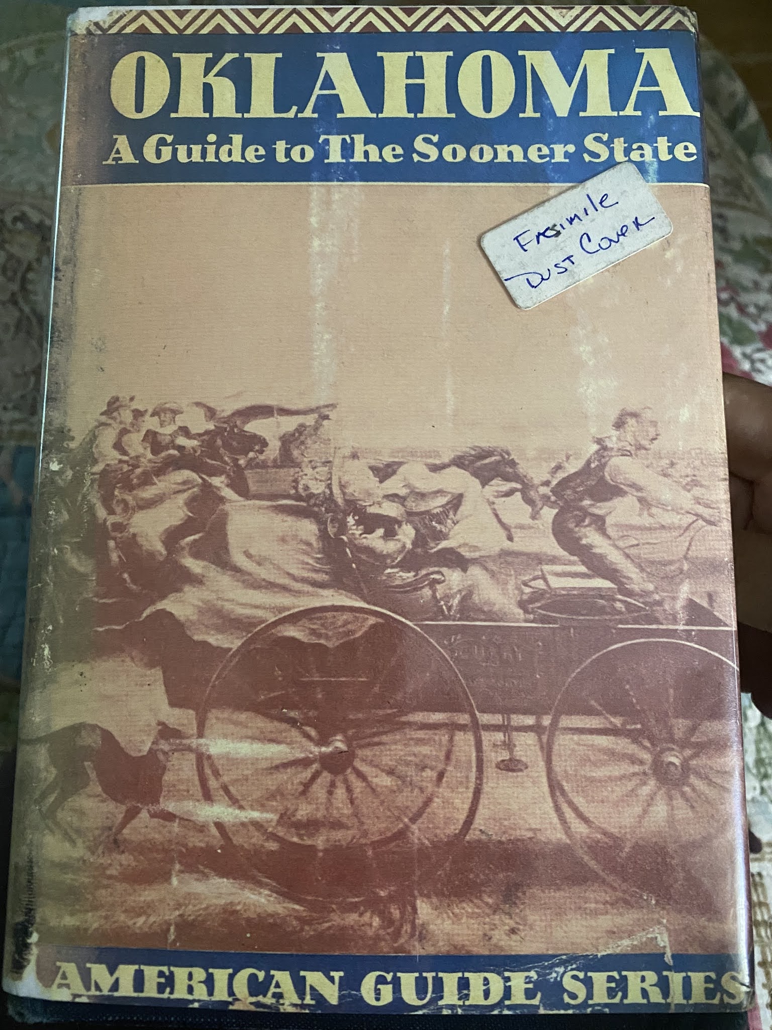
This book, written in 1941 as a part of F.D.R.'s Federal WPA program, is a fascinating read (as are all in the series). Half geographical guide, half bs propaganda on the "imagined" America of whatever writer and/or editor(s) wanted you to see/believe about our country, it has some tidbits like these:
US 60 traverses the confines of the old Osage Nation, now Osage County. Indian teepees once dotted the rocky hills but today they have been replaced by "stripper wells" and "pumping jacks."
In 1872, the Osage Indians were removed from Kansas to Silver Lake, and then to this tract of almost 1,500,000 acres...
Their new lands were composed of hills and prairies, which was much to their liking, for they were naturally hunters and fighters rather than farmers.
...Others adopted the white man's way and became ranchers themselves.
During the period of luxury for the Osages, it was not unusual to see a blanketed Indian-braids down his back and a stetson on his head- at the wheel of an expensive automobile...
Chief Bacon Rind's (I kid you not- it is in this book on page 289, whose Native name was Wah-she-dah or "Star-That-Travels") home...has been allowed to deteriorate since his death ...one of the best-liked Indians. After his death...the funeral was a strange mixture of traditional Christian and Indian burial rites; weirdly singing mourners were employed...
The town, which still has the traditional Indian atmosphere...
The Pawhuska of today in so many ways could resemble the "old days," including these signs.
Speaking of old, my husband became very nostalgic upon seeing this green dinosaur as we drove into town. He couldn't believe that I didn't remember it. We grew up in the era of logo's, but I did not get this one.
It belongs to this product- Sinclair gas. Here's what they have to say about themselves:
"The Sinclair dinosaur is one of the most popular icons in American petroliana."
Apparently, the dino was dreamed up in a 1930 (no my husband was not around then) ad campaign to promote the idea that lubricants refined from crude oil were believed to have been formed when dinos roamed the earth. The dino was trademarked in 1932 (nope hubby STILL not around yet).
DINO first appeared as a balloon in The Macy’s Thanksgiving Day Parade in 1963 and quickly became an annual fan favorite – so popular that in 1975, he was named an Honorary Member of the Museum of Natural History.
Aha there is the missing link (to my hubby's identifiation)!
Fiberglass DINOs began appearing at Sinclair stations across the country in the early 1960s. He’s still a favorite photo op today (hence the picture above). We do not have Sinclair gas back home in Massachusetts.
Okay, so now I must tell a funny little story. I booked this tour from the internet. Here I was thinking I was going to this large Indigenous People area and this tour would be all about the history of the area and the people (Osage in particular). We show up at our allotted time to find out that we are the only tourists going out for this 90 minute adventure. Fine by us (sort of), and so off we go. The tour guide went on and on for about a good 30 minutes about things we knew nothing of and that had nothing to do with Osage people. I was so perplexed and looking over at my husband, it was clear he had no clue. Finally I had to stop the woman and ask what she was talking about.
"You know the Pioneering Woman, right?" she says. We shake our heads no. "The Drummonds?" Again a head shake no. "The Food Network on TV?" She asks in exasperation this time. More head shaking no. Finally I offer up the fact that we don't own a tv and thus have never watched the Food Network.
I explain that I thought this tour was a historical tour of the area and the Osage folk who live here.
There was a pregnant pause in the air conditioned mini-bus, and the air seemed to get icier as it dawned on the driver that we were not going to be the typical Anglo tourists she was used to driving around.
In the 30 minutes of bizarre talk we did endure, we learned a few things- 1. somehow the Drummonds were the White people of Pawhuska's demi-gods/royalty/wealthy folk and 2. These demi-god'ish folk had intermarried with Food Network superstars 3. A spin-off of all this is a very trendy, very popular merchandising outlet called "The Mercantile." 4. Boy Scouts of America was invented in Pawhuska, and 5. There was a famous Hollywood star (cowboy/stunt man) who came from here named Ben Johnson (I knew only a Black man and famous Olympic sprinter with that name, but hubby nodded his head like he knew him).
The other things we learned that we knew a little about was the whole "Hollywood Comes to Pawhuska" scene, as this tour had adapted itself to cover the big doings of all this meant. This was the first time the tour guide mentioned the Osage, but she did not say "Reign of Terror," or go into any depth except to say "I guess it was unfortunate what happened to that poor family." No mention of the many other deaths related to the time period. The tour guide gave more air to the White writer of the best selling book and had in fact included with the tour an interview with Grann and a clip from the another movie (The FBI Story) done in the 1950's with Jimmy Stewart that focused on the incident.
All in all it was a VERY bizarre tour. Trying to listen to the weird history, look around, and watch a mounted screen with movies. BUT, it was air conditioned and it was incredibly hot the day we were there.
Here is my series of shots from the tour (the woman toned down here disparaging remarks about "them" people, how "we" were gaining ground on getting more and more of "their" land, and using the "red" term she started the tour with). It was still very clear to see it was a sort of "Tale of Two Cities," divided between the now majority White, and the now minority Osage. I thought there was also an undertone of disdain for the governmental allotments, treaties, and ongoing support the Osage Nation receives. Never have I felt more of the White hegemony that has overtaken this once Indigenous land and the "Manifest Destiny" beliefs that fueled the expulsion and slaughter of Indigenous people in the quest for westward expansion. Frankly, the whole tour made me feel ill and so duplicitous in ongoing racist behavior of our nation. And the sad thing was that the tour took so long that the many Osage sites I had wanted to see were closed when we were done.
Before I go any further, I must SHOUT OUT an excellent documentary from OK Public TV that came out in January 2021 called
It was hard to say whether these were townsfolk, tourists, or extras for the movie being filmed. The town certainly was bustling, but not quite like in the old days.
Not sure what Anabaptist group these folks are from (I am guessing Mennonite), but I sure do wonder about their history to the area and the Indigenous people. Of course I couldn't ask, which makes me bonkers b/c I really want to know.
Part of the curiosity is of course fueled by the federal government's policy of forced assimilation (Indian boarding schools) and religious groups complicity in this awful affair. I certainly know that there were many Quaker and other Christian (Catholic) missionary efforts that led to involvement with the Boarding schools.
An interesting read on modern day efforts of Quaker/Friends folk "facing their history"
"The National Native American Boarding School Healing Coalition says that for healing to occur, the full truth about the boarding schools and the policy of forced assimilation must come to light in our country, as it has in Canada. The first step in a truth, reconciliation, and healing process, they say, is truth telling. A significant piece of the truth about the boarding schools is held by the Christian churches that collaborated with the federal government’s policy of forced assimilation. Quakers were among the strongest promoters of this policy and managed over 30 schools for Indian children, most of them boarding schools, during the nineteenth and early twentieth centuries. The coalition is urging the churches to research our roles during the boarding school era, contribute this research to the truth and reconciliation process, and ask ourselves what this history means to us today."
AND while I am on this tangent, there was also "much ado" from our tourist guide about the wonderful, historic church in Pawhuska- Immaculate Conception (her words which reflect Anglo name) or Cathedral of the Osage (reflect tribal name):
THEN:
NOW:
Our view and my feeling= just another Christian church, so what. But obviously this church was/is a big deal to many in the community. This church became an intersection point (besides intermarrying/mixed bloods which also happened) and also a National Historic place with it's own Wiki page https://en.wikipedia.org/wiki/Immaculate_Conception_Church_(Pawhuska,_Oklahoma
The stained glass which could not be easily viewed from our tour van, has quite the story as well:
The stained glass windows of the historic Immaculate Conception Church in Pawhuska, commonly called the Cathedral of the Osage, have attracted global interest due to their unique history. When construction began in 1910, the local members of the Osage Tribe wanted only the best for their church, so they turned to Old World craftsmen in Germany for the stained glass windows, two of which depict members of the Osage tribe who were living at the time. The partially-completed windows survived WWI, during which they were buried by the craftsmen to protect them from Allied bombing raids. After the war they were excavated, completed and shipped to Pawhuska where they were installed in 1919.
Obviously there is pride in this place. Not sure all in the Indigenous community share this view however.
Then of course there is always the Media and that good ole adage "fair and accurate" reporting. Only, when you read articles like this one from 2019 in "Tulsa World,"
and lines like this: "However, the link between the Osage and Catholic Church seems rather unique," and "...And, all of our congregation is very proud of that history.”
This stained glass that the Osage had made is a rather unique on, even I have to admit.
MOVING ALONG...
Although not quite in downtown any more, there was also this marker:
Another wanting to know more moment. These markers were all over the state. Check out this graphic:
And you can see that there was a GREAT push on to get the Indians acculturated to the "white man's ways" in Oklahoma.
There is still one Bureau of Indian Education (BIE) boarding school, and one tribally-controlled boarding school in Oklahoma today.
BUT...
There still is awareness (at least in the world that I inhabit, which is Educational) that the dark history needs to be addressed in relation to the Cultural Genocide many feel happened to Indigenous People in the US (yes of course it has been heightened since Canada publicly admitted to their shameful past). I mean check out this headline (10/2020) from one of the largest Educational Publications in my field, "Education Week":
Now I just better leave this issue alone and ease on down the Pawhuska road.
THEN:
NOW:
Not quite like in the boom years, there are many tired-looking spots and some blight on the ends, but in the middle is some bustle from the Pioneering Woman tv fame and spin-off product sales at "The Mercantile,"and of course the movie making. Pawhuska has had other movies filmed in the town + area, but this is a big time movie with big name people AND it is about what happened to Indigenous folks at the hands of White folk.
It was hard to figure out what the tall building on the hill was from this vantage point (we found out later on the tour). Also, quite a few abandoned properties even if the town was teeming with folks.
Little signs like this "No Crew" one were all over town. We saw the exact same ones around our area (filming for Dexter took place in Western MA this Spring).
I thought some buildings were simply, solidly gorgeous and City Hall was one of them. Originally built in 1894 as the Osage Council House (to be the main gov't building for the Osage Nation). The hand-cut stone is what I love. When statehood came, the Osage Nation set up its own governance and sold the building to Pawhuska, OK
What was going on under those mysterious tents??? Production place for the film crews.
As we drove through the downtown of Pawhuska, the tour guide spent more time on the filming side of going ons vs. the history of the place (a bummer for us). It was hard to keep up with what was really there vs.fake-made for the movie.
This notorious building was there, has some history, but nowadays it is a boutique hotel. Here is a "THEN" photo:
Nefarious. That is the only word that comes to mind. And stays on my mind the entire time I am in Osage County. Not the Osage County of the famous play turned into movie (also filmed around here) that was really about the messed up inner workings of an Anglo family.
The triangle or "flat iron" building at one time (circa 1920) had over 100 lawyers in it. White men who had come to the area, set up offices, all for the purpose of "helping" the poor, hapless Indigenous folk who had come into oil money in the Osage Nation Oil Boom years. The federal government and these white lawyers and the network of other nefarious folk are what give this town its bad juju.
But I get way ahead of myself here. I think now would be a good time to SHOUT out the OTHER novels that I read:
The Deaths of Sybil Bolton and
Bloodland: A Family Story of Oil, Greed and Murder on the Osage Reservation
These novels were written years before white dude Grann, and the author, Dennis McAuliffe, Jr. is also a journalist (like award-winning Washington Post Journalsit) like Grann, but he is also an Osage whose grandmother was murdered during the awful time of the Reign of Terror. In fact, now that Grann and Scorcese have elevated this piece of obscure history, The Deaths of Sybil Bolton has been reissued this year.
Anyway, it was like a horror story learning of this bizarre occurrence in American History, so I vowed on day to visit. And now here is I was sitting looking at a brick building that seeped evil all over the place. Who cares that it is now "re-invented" as a boutique hotel, housing mostly Anglo folk who come to see the Food Channel/TV world stars, buy affiliated merchandise, and step all over the Osage Nation without a care to them or their history.
Lurking in the background is the town courthouse. It was here that the nefarious acts of the white citizenry were exposed and several were held accountable (with untold numbers escaping justice- so many injustices all around here, it makes me sad).
The courthouse was built in 1914 and is a quite impressive structure.
Is it real or is it fake. Very hard to tell. The main thrust of the tragic story did not actually take place here in Pawhuska, but in the nearby much smaller town of Fairfax. Unfortunately, this already diminished and somewhat blighted town was struck by a tornado in 2018, destroying many of the storefronts, so they were being recreated here in Pawhuska.
From a different angle you could see that these were not actual places. It was sort of freaky.
Notice the window lettering?
Notice the window lettering?
All over town this was the scene. Will have to go back and reread the books I read to match the names to the places. It was amazing how industries and businesses were started by white men to price gouge and take advantage of the Osage money that came during their golden era from the oil boom. I can't even imagine what it was like. In that way movies are magical for recreating what once was. Later, when we visited the original places from the books, it was a stark reminder how much time and history had ravaged them.
This building was once iconic to Fairfax, Ok. Built in 1913, it was torn down in 2020. It was the biggest business in Fairfax, and the owner at the time of the Reign of terror was complicite in the awful deeds going on. In fact, the company was sued in 1925 for the inflated cost of a deceased person's funeral.There was word that a memorial to the murdered Osage may be put in up in the empty space.
Here is how some of the white settlers from this area are written up in history:
Homer Huffaker
One of the pioneer white men in the Osage country, identified with the thriving Town of Fairfax since its beginning, now the head of one of the largest mercantile concerns there, and also one of the present county commissioners of Osage County, Homer Huffaker is one of the men who have made their influence count for improvement and development in this section of the state.
He belongs to one of the oldest and most prominent pioneer families of the State of Kansas.
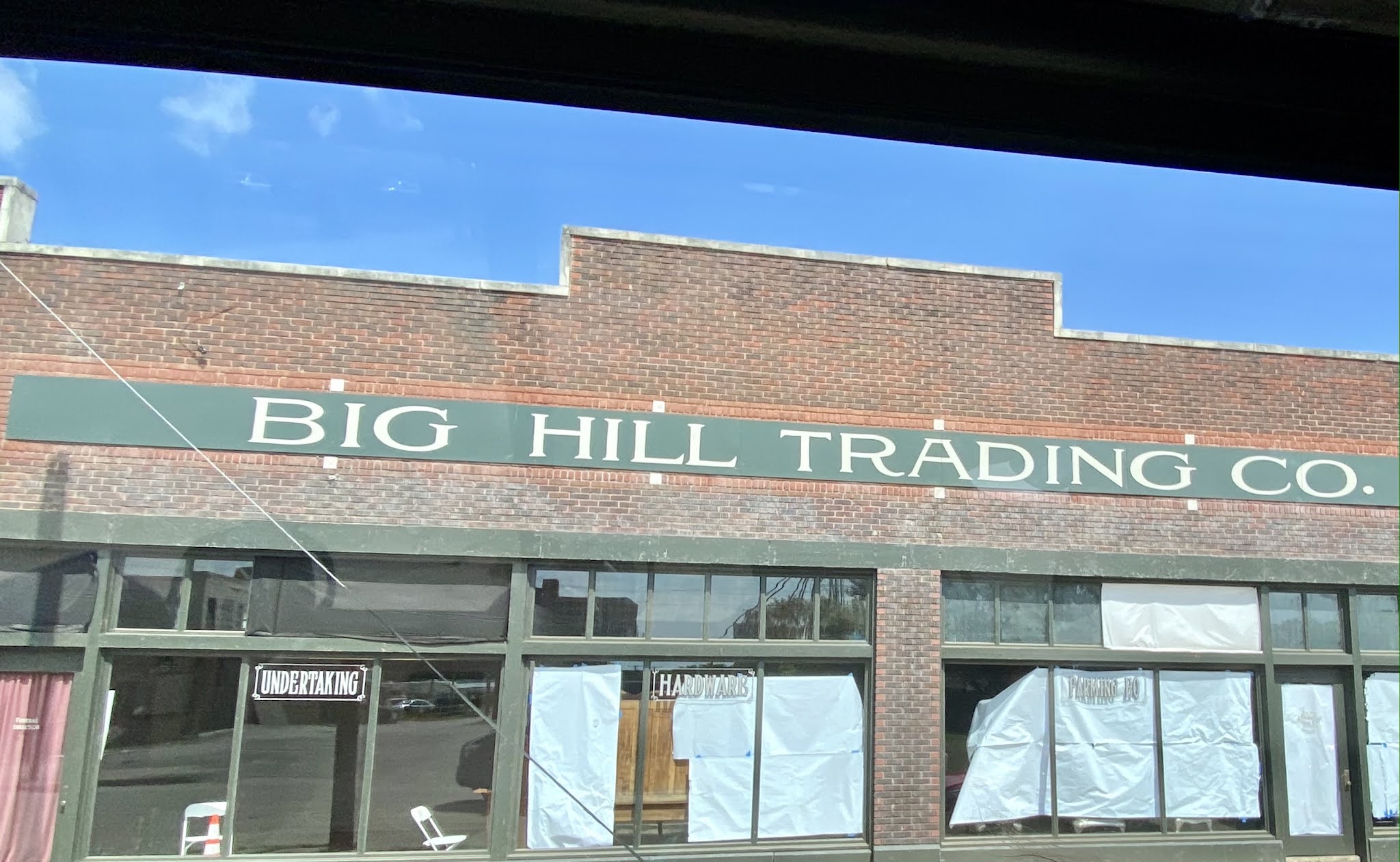
...He became an assistant at Gray Horse in the Osago Nation to L. A. Wismeyer in the trading store, and remained in that locality until 1903, when he joined in the business exodus from Gray Horse to the new railroad town founded by Mr. Wismeyer and named Fairfax. For two years Mr. Huffaker was assistant cashier in the Osage Bank of Fairfax. When the Wismeyer Mercantile Company was formed and incorporated he became its secretary and treasurer, and was identified with the concern in that capacity for ten years. In 1913 he organized the Big Hill Trading Company of Fairfax, and is now its president. This firm carries a large stock of general merchandise, and has extensive trade relations both with the white and Indian population around Fairfax. In many ways Mr. Huffaker has been identified with the business and civic upbuilding of Fairfax since it was founded. In 1907 he added to the improvement of the town by the erection of the fine home in winch he and his family now reside. He has also acquired farming and stock raising interests in that locality.
In politics he has been a republican voter for twenty years. In 1912 he was elected county commissioner of Osage county, served as chairman of the board during his first term, and was re-elected in 1914. He was also chairman of the first delegation which chose a representative for Congress from the Osage country, and assisted in nominating former Congressman Bird S. McGuire. Mr. Huffaker is a thirty-second degree Scottish Rite Mason, belongs to the Nobles of the Mystic Shrine, and is also a member of the Elks Lodge of Pawhuska.
Mr. Huffaker is a master of the Osage language, and readily acquired fluency in that tongue within a short time after coming to the Osage country.
Ain't Mr. Huffaker grand!?! Nothing about price gouging or taking advantage of the Osage in the territory. Nothing about the history of the name of his store. Big Hill was a band of the Osage living in the area (Grayhorse and Fairfax).
Even the Drummond family, now of National fame and all over Pawhuska and Bartlett, Ok. has a history going back to the "pioneering days" when white folks made lots of money off the Osage.
...Prentiss Price and F. Gentner Drummond of Hominy, Osage County, were among the Fairfax National Banks stockholders in 1906 when it was established.
The Drummonds also ran a trading post (among several other enterprises) in their home territory of Hominy, OK (south of Pawhuska/Fairfax) and one of their associates/employees, D.C. Maher, later paired up with Huffaker and John Bird to form the Big Hill Trading Co. Maher was also involved in the bank in Fairfax. AND, when Maher died, his widow married another nefarious character in the "Reign of Terror" cast. John Bird too was involved in many other shady dealings with the Osage even if it wasn't murder. Oh the tangled webs that were spun!
So enough of the side story, I can get so outraged and involved just by thinking about what happened 100 years ago. The fact that I spent money to hear this white woman drive us around and go on and on about the Drummonds and how wonderful they were/are, and even hint at how they are more powerful and wealthy than ever before, and that they can even accumulate more and more land from "them people," and the white man will someday soon rule the territory; made me want to rage and puke. Neither of which I did, I just rode on and observed the sites.
This is also a fake scene. It is a fabricated railroad station, made and situated by the Bird Creek in Pawhuska, even though it was Fairfax that had the station.
In the southwestern section of the reservation were a few small towns that were Indian villages. A white man convinced the RR to have a depot in the town that he basically was running, even though the Osage retained title to to the townsite acreage. The RR bypassed Gray Horse and built in Fairfax instead. After that Fairfax grew steadily, while Gray Horse remained a small village/town. Today both places are small, with Fairfax having lost almost half its population (pop. approx. 1,400).
NOW:
THEN:
More made up storefronts in downtown Pawhuska.
MAIN ST. PAWHUSKA THEN:
NOW:
As you can see it was once a thriving frontier town with an oil boom attached. Now it is sort of faded and worn-looking, with some attempts at rejuvenation.
AND then of course there is this place: The Mercantile. Let's dip inside for a minute, take a look see.
Like how they make it seem like this new phenom of a food network show and off-spun product industry is old and well-established? Like really- was there even tv in 1910?!?
Yeah right! Nothing old inside this store, unless you are counting me.
In a strange twist to my constant search for integration of races and cultures, there was the awkward moment when I went upstairs to get an iced coffee and saw "back-of-the-establishment" workers with brown skin, whereas there were none on the 1st floor in the merchandise/clerk area. Just observing...
In the pictures below, there was another odd occurrence. I had specifically wanted to drop into this unique little store that I read about, "Sister's Attic."
It is a consignment shop that doesn't look like much from the outside.
Look what was advertised out front. I thought for sure I would get to meet and talk to Osage folk in this integrated store.
It seemed to be like a community center'ish sort of place with this bulletin board and all
But when I saw this article I started to have 2nd thoughts.
Even this one gave me pause.
By the time I got to this one I was downright dismayed. No mention anywhere about the use of Indigenous actors in the movie. No word from the Osage on how it felt to have Hollywood around here dredging up the awful history visited upon the Native people. When we got to the counter, there were two blonde white woman, one of which callously mentioned to her coworker that she had no idea on how to pronounce the name of the Osage woman she needed to call in response to my inquiry on a consignment piece. They bantered around a couple of pronunciations will I impatiently waited. I was so bummed out. Where is the coexistence? It really did seem like a tale of two cities, and I was only getting to hear/learn about one side.
In the end, we found a magnet for our travels collection that was done by a fellow from the Muscogee Nation,
Now let me backtrack and show what our little tour reluctantly took us to.
THE OTHER PAWHUSKA:
Grandview Ave was an incredibly long road that starts in downtown, then goes up on a rise that felt like a bluff, and up here were many of the Osage Nation structures. Some people call this place "Agency Hill." I won't get into how this place was described to us by our tour guide. Suffice to say they were not kind, friendly, or neighborly words.
The Osage Agency proudly serves the Osage Nation, administering leasing and development of the 1.45 million-acre Osage Mineral Estate and overseeing more than 135,000 acres of trust and restricted lands in Osage County, Oklahoma.
It was fascinating to see things like reserved parking signs written in both English and the Osage language.
Osage Agency campus houses beautiful native sandstone buildings. The complex dates from 1872 and has the original agency, dormitory, and ceremonial elm tree.
Superintendent's Home has been residence to 30 Osage Agency Superintendent's and is listed on the national Register of Historical places.
Osage Nation Human Resources Office
The Million Dollar Inn is what the sign says. It is a property across the street from the Osage Agency complex. This is an Osage owned and operated business. Our tour guide did point out a few of these things. What stayed with me was the pejorative term she first used in describing the homes that Osage folks built. "Red Mansions" was how she disdainfully labeled the first one that she pointed out. These homes are sprinkled all over the territory and they were distinguished by the use of local brick (hence the double-entendre meaning of "red"). However, not all the homes were brick.
To the right in this photo is Chief Claremore statue done by Osage Sculptor John Free. Osage Nation Tells its Story
I was so jealous to see these two actually visiting. Although the tour guide slowed the van for a minute or two, she never stopped and never asked if we wanted to get off to look at anything.
Osage Nation Treasurer's Office
The Osage Nation Museum is the oldest tribally-owned and operated museum in the United States. The Museum opened its doors in 1938. Heartbroken that we did not get to visit.
Many different homes along Grandview Ave. It definitely was "the" place to be. Perhaps still is. Not sure how much is Osage-owned nowadays. The 2010 census showed only 14% Native American and 66% White.
This was one of the "Red Mansions" pointed out to us. Osage-owned.
This is the side of the Wahzhazhe Cultural Center. It is towards the far end of Main St.
The Misson Statement of this center:
To ensure the survival of the Wahzhazhe nation of people, we will share, preserve, and celebrate the values, teachings and tribal ways that our elders entrusted to the present and future generation. Our Strength will come from the commitment of our Wahzhazhe people and the knowledge that the Wahzhazhe nation is blessed by Wa-Kon-Da.
This 1927 former bank building is also owned by the Osage.
Even the visitor's center was closed when we got off our awful tour ride. I so felt like crying.
This ranch sits almost directly across the street from the Drummond Ranch, which kind of sums up the relations around here (kind of like in your own neighborhoods. You know- the neighbor you are nothing like, but you each tolerate the other but don't hang together or anything):
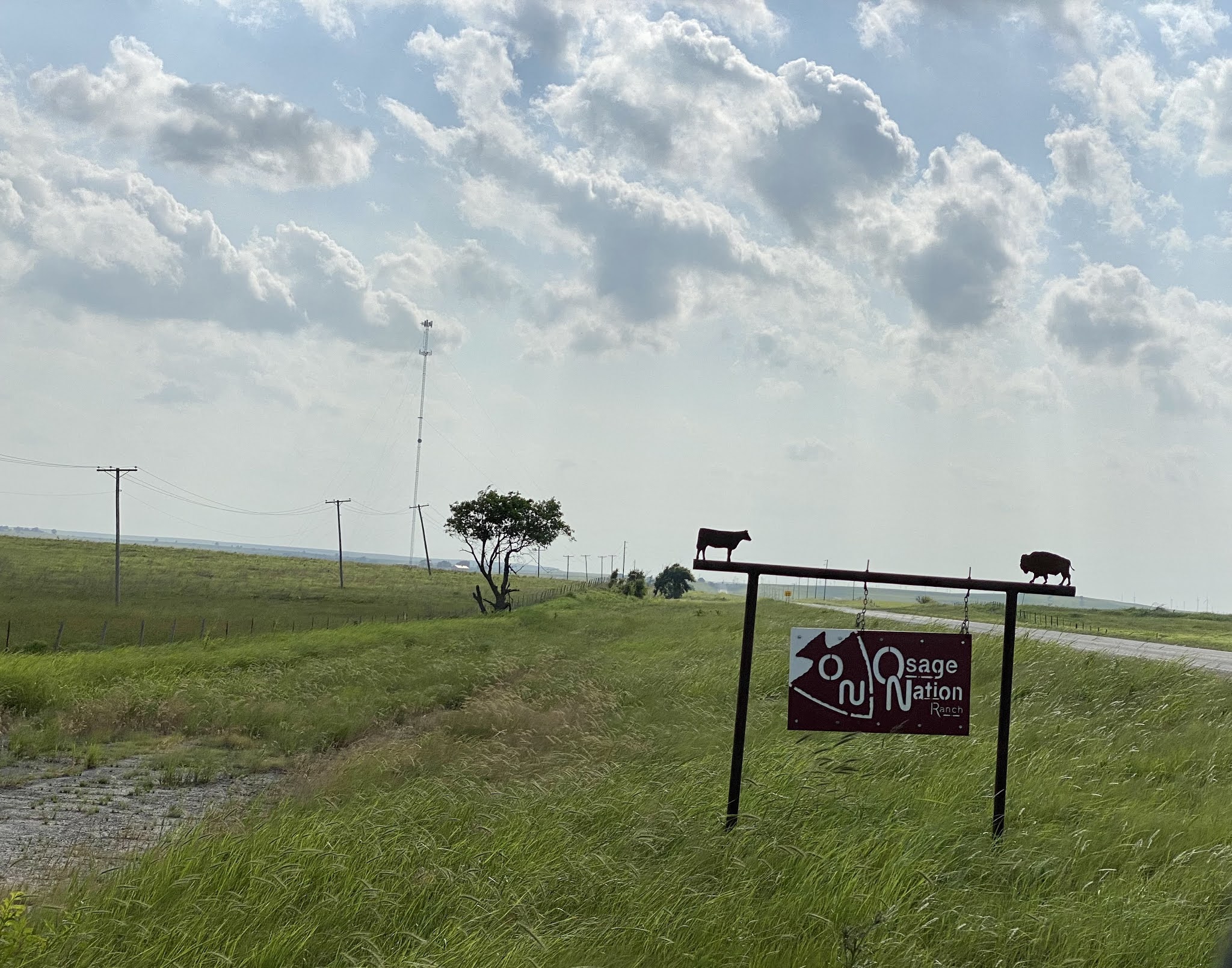
The Osage Nation Ranch is a limited liability company wholly owned by the Nation. The 43,000-acre ranch, purchased from media mogul Ted Turner in 2016, was named the Bluestem Ranch by Turner.During the 2019 Hun-Kah Session, the Sixth Osage Nation Congress unanimously passed a resolution to change the name of the Bluestem Ranch to the Osage Nation Ranch, at the request of its board of directors. The ranch includes cattle and a bison preserve.
THE REST OF PAWHUSKA; the good, the bad, and the sort of run down
I was so curious about this place. It sort of looked like a multi-unit apartment or some such building.
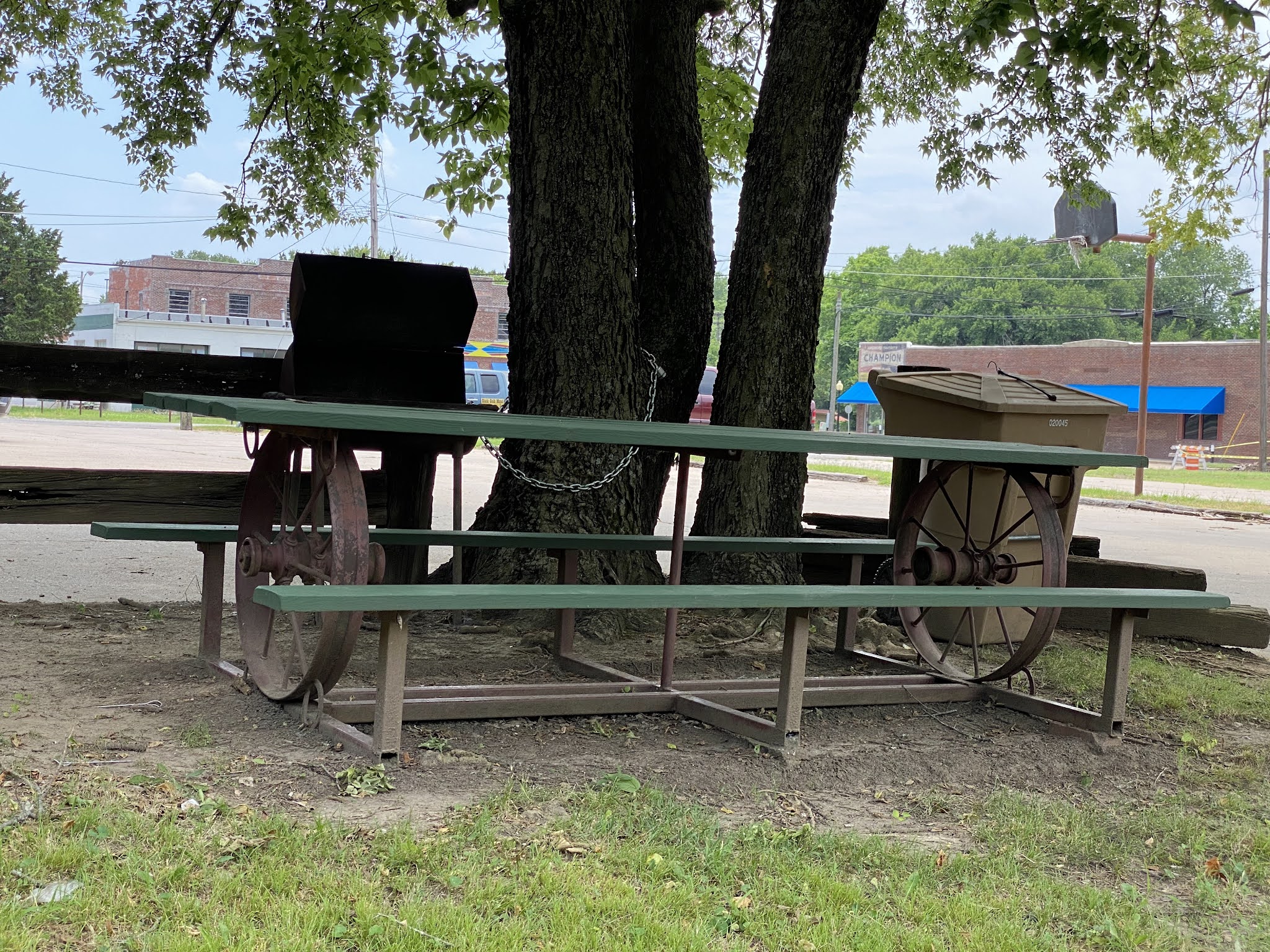
A pioneering picnic table. Far Out!
A back street, one-off from Main St. (W. Fifth St.) near Bird Creek. The latest in fashion= a glamping pod. There are only 3. They are $80/night and have
ADA Accessible
Air Conditioning
Electricity
Heat
Water Hook-Up
This place was new and unfinished when we came through. They have since added a general store.
The Dam Place a general store and campground that is operated by Help Works, a non-profit organization.
Sounds pretty good...except that this was their neighbor.
And oddly enough, the general store for the pods is located on Main St. A very strange set-up indeed.
New Library
There obviously were the "haves" and the "have nots" sections, but alas, we learned very little about the town folk excepting of course The Drummonds.
Nope! Didn't go there either.
So then we head out this long long road
High up on the land it felt like and then we came to...
Once upon a time this was the scene for miles around. It was truly what being on the Prairie was. Now Kansas has the largest remaining area and this piece is owned/managed by the Nature Conservancy.
The Joseph H. Williams Tallgrass Prairie Preserve at 39,650 acres is the largest protected piece of tallgrass prairie left on earth. Urban sprawl and conversion to cropland have left this once expansive landscape, originally spanning across 14 states from Texas to Minnesota, at less than 4% of its original size.
Since 1989, The Nature Conservancy in Oklahoma has worked to restore this fully functioning portion of the tallgrass prairie ecosystem with the use of 2,500 free-ranging bison and a "patch-burn" model approach to prescribed burning.
In case you were wondering, no Joe Williams is not an Osage. He is former Williams Co. CEO, chairman of both the Oklahoma Board of Trustees and the National Board of Governors for The Nature Conservancy, and lifelong hunter, fisherman and conservationist. At first the Osage were not for this project, not sure why.
Yeah for Nature Conservancy!
We drove all the way up there and stared at the grass. It was odd and awkward.
Then we headed out of town and for a minute I thought we were going to Fairfax!
Of course we weren't! We had to drive here and see this. The famous Drummond Ranch. Can't you see it? Neither could we. But we did sit there for at least 20 minutes while tour guide woman droned on and on and on about the Drummonds.
There it is. Squinch your eyes and you'll see it.
FINALLY THE AWFUL TOUR WAS OVER!!! The oddest picture of the day was to be had when we got back to the old rundown gas station where we began this nightmare journey. Waiting there for us was the 2nd tour bunch b/c we were running late (all that Drummond talk) and these folks:
Now I don't know what their arrangement with these folks were, but what tourist is going to want to buy a huge watermelon? Yet there they perched, looking hot and bored. I wondered where their farm was? I wondered if there was an enclave of Black folk around these parts b/c that was the first time I saw more than one black person hanging together. I didn't stick around to ask.
We got in our car and we drove right back out to the prairie on our way as we headed to Fairfax, Ok:
Found this restaurant as well on the way out of town. It was in the August: Osage County movie.
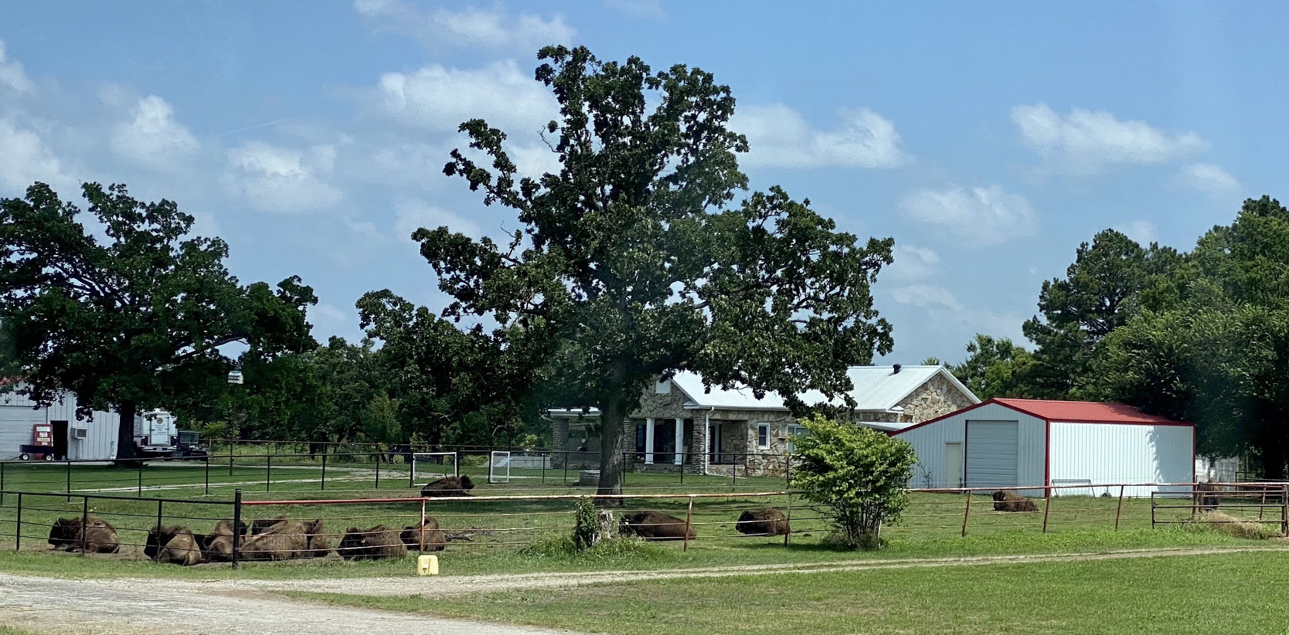
Found Bison
Not sure if this is part of the Osage Ranch or not.
It was forever windy, and hauntingly quiet. An odd peacefulness settled over me.
Even found film crew signs along the highway. Damn movie people were following us and taking over entire parks (Osage Hills State Park w/ CCC buildings I so wanted to see) + shutting off public spaces. So glad they had already filmed in Fairfax and Gray Horse!
And while I am on the movie rant, just read about this:
If I ever finish this, I will have it all down and can refresh my memories when the film finally comes out in 2022.